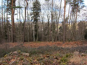
Heidenkeller Castle
| Heidenkeller Castle | ||
|---|---|---|
|
Heidenkeller Castle - Wall in the west of the complex |
||
| Castle type : | Hilltop castle | |
| Conservation status: | Burgstall | |
| Place: | Ettenheim -Münchweier | |
| Geographical location | 48 ° 14 '15.1 " N , 7 ° 52' 16.7" E | |
| Height: | 354 m above sea level NHN | |
|
|
||
The Heidenkeller Castle is an abandoned high altitude castle at 354 m above sea level. NHN on the south side of the Münstertal near the Münchweier district of the city of Ettenheim in the Ortenau district of Baden-Württemberg .
The Heidenkeller Castle is, like the Gisenburg , probably the remains of a pre-Christian Celtic refugee castle and indicates the early settlement of the Münstertal. Their area covered an area of about 75 by 35 meters, which was almost completely surrounded by a wall. In the south there was a neck ditch that has meanwhile been largely filled in . A ceramic find was dated to the Hallstatt period.
The stones from Heidenkeller Castle were used at the beginning of the 19th century to erect an octagonal "stone viewing pyramid" with stairs to enable a view of the Rhine plain .
Web links
Individual evidence
- ↑ Mention of Heidenkeller Castle at ettenheim.de ( memento of the original from January 10, 2017 in the Internet Archive ) Info: The archive link was inserted automatically and has not yet been checked. Please check the original and archive link according to the instructions and then remove this notice.
- ↑ see badische-seiten.de


