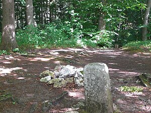
Stahleck Castle (Lichtenstein)
| Stahleck Castle | |
|---|---|
|
Castle site |
|
| Creation time : | until 1200 |
| Castle type : | Höhenburg, spur location |
| Conservation status: | Moat |
| Standing position : | Nobles |
| Place: | Lichtenstein- Unterhausen |
| Geographical location | 48 ° 26 '31.4 " N , 9 ° 17' 49.4" E |
| Height: | 711 m above sea level NN |
Stahleck Castle refers to an abandoned hilltop castle at 711 m above sea level. NN high mountain spur above the Echaztal , about two kilometers northwest of the church in the village of St. Johann-Ohnastetten in the Reutlingen district in Baden-Württemberg .
The castle was first mentioned indirectly in 1254 with "Konrad von Stahleck" . It was possibly in the possession of the Lords of Greifenstein, but since it was not destroyed with the other Greifenstein castles in the Reich War in 1311, this seems questionable.
Of the former castle complex, only the moat is visible today.
literature
- Christoph Bizer: Surface finds of castles in the Swabian Alb - A contribution to ceramic and castle research . Published by the regional council Stuttgart - State Office for Monument Preservation, Konrad Theiss Verlag, Stuttgart 2006, ISBN 3-8062-2038-7 , pp. 125–127.
- Günter Schmitt : Castle Guide Swabian Alb, Volume 4 - Alb Mitte-Nord: Hiking and discovering between Aichelberg and Reutlingen . Biberacher Verlagsdruckerei, Biberach an der Riß 1991, ISBN 3-924489-58-0 , pp. 311-314.

