Uttum Castle
| Uttum Castle | ||
|---|---|---|
|
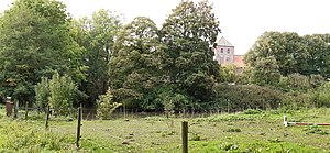
Burgstall Uttum from the south from the presumed outer bailey area; Moat visible; behind it Uttum church with the crooked church tower. |
||
| Creation time : | 14th Century | |
| Castle type : | Niederungsburg, location | |
| Conservation status: | Burgstall | |
| Place: | Uttum | |
| Geographical location | 53 ° 27 '5.7 " N , 7 ° 9' 16.4" E | |
|
|
||
The castle Uttum is a Outbound castle in the East Frisian municipality of Krummhörn in the district of Aurich in Lower Saxony . It stood in today's Krummhörner district of Uttum . At the time the castle was built, the place had a navigable direct water connection to the North Sea with the Wolder Tief .
history
The castle stood south of the Uttum church . Possibly it had a previous building from the 13th century, which the chief Beninga family probably had expanded in the 14th century to a stone house similar to the preserved stone house of Bunderhee and in the 15th century to a castle. A Ghompo Hoyersna was named as the first chief in 1412 . Between 1450 and 1493 Beno is named, who married Etta von Nordorp from Harlingerland in 1454 . His name is engraved on one of the bells in the church tower, because he was also the provost. Their daughter Frouwa married Ailt Allena von Hinte and their eldest daughter eventually married Wiard von Oldersum , who thereby became the castle owner. Through his only daughter Etta , the seat of the castle and chief was passed on to husband Omko Ripperda von Jarmsum . A tower inscription on the church attests to him in 1537 as chief of Uttum. In the 17th century the castle came to Diedrich Arnold Hane zu Leer and his heirs. Two coats of arms in the choir of the church bear witness to this among other things. End of the 17th century had Baron Habbo of Westendorph that now by noble Good .
Castle remains
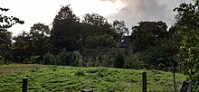
Towards the end of the 18th century, the buildings were torn down, but their place is still clearly visible today: the castle's rampart and moat systems have largely been preserved. The inner castle area covers an area of around 40 by 40 meters. The almost square surrounding and still completely existing moat is only interrupted to the north by a driveway. Today there is a modern house on the former castle grounds.
Today, a second trapezoidal trench system runs around four times its size. This outer bailey, which surrounds the castle stables to the east, south and west, can only be assumed based on the moat system. Today's castle area is about one meter above the surrounding level, but still about 1–3 meters below the terp level of the church and the old town center.
Others
In Uttum, as in many Frisian towns, there is said to have been a second castle, which is documented as Redardsnahuus in 1425 ; but their location is not known and nothing has been handed down structurally.
Several epitaphs or heraldic stones of the chiefs and castle owners are present in the church.
Web links
- Entry by Frank Both and Stefan Eismann on Uttum Castle in the " EBIDAT " scientific database of the European Castle Institute
Individual evidence
- ↑ a b c d e f local chronicles of the East Frisian landscape : Uttum, municipality of Krummhörn, district of Aurich . Retrieved April 18, 2016.
- ↑ This probably means Jarßum .


