
Cagayan de Tawi-Tawi
| Cagayan de Tawi-Tawi | ||
|---|---|---|
| Waters | Sulu Lake | |
| Geographical location | 7 ° 1 ′ N , 118 ° 28 ′ E | |
|
||
| length | 14.6 km | |
| width | 9.4 km | |
| Highest elevation | Mount Ledan 329 m |
|
| Residents | 29,801 (2007) | |
| main place | Barangay Lupa Pula (Pob.) | |

Cagayan de Tawi-Tawi is the name of an island in the Tawi-Tawi Province in the Philippines . Before the establishment of the province of Tawi-Tawi, the island was called Cagayan Sulu (name added after the Sulu Sea ). The addition to the name is necessary to avoid confusion with the island of Cagayan (also Cagayancillo, also in the Sulu Sea, but a good 400 km northeast). The local Jama Mapun refer to their island as Tanah Mapun, which translated means land of the Mapun.
The island is located in the southwestern part of the Sulu Sea about 295 km off the north coast of the provincial capital Bongao , 350 km west of the Zamboanga Peninsula , 220 km north is the island of Palawan , 120 km southwest is Borneo and 80 km away are the Turtle Islands . The island has an area of approximately 172 km² and is administered by the municipality of Mapun . In the 2007 census, exactly 29,801 inhabitants were registered.
The island has a heart-shaped shape, with a sprawling peninsula in the southern part. The island is 14.6 km long and 9.4 km wide and has numerous islands, coral reefs and sea grass meadows in front of it (belonging to Barangay Boki). The Muligi Islands, consisting of Muligi Diki and Muligi Mihi, are located 12 kilometers south-southwest. Only 300 meters from the western tip is Bulissuan Island (part of the Barangay Sikub). The northernmost island is Keenapusan 15.5 km north-northwest of the main island (part of the Barangay Umus Mataha). In between are the islands of Pamelican, Bintut, Bohan, Bisu Bintut, Bisu Bohan, Mandah, as well as Silumisan and Lapunlapun just off the coast.
Due to its remote location, no tourism has been able to develop so far. The topography of the island is very flat, the highest point being Mount Ledan. It rises 329 meters above sea level. The vegetation of the island consists of a dense tropical but very low vegetation, in the interior of the island there are also smaller agricultural areas. Lake Danao (24 ha) and Lake Singuang (29 ha) can be found near the south coast, both of which are volcanic crater lakes that are fed by freshwater springs. Jurata Bay is located nearby, it forms a natural harbor and was created by a volcanic eruption. It was used as a port by the US Navy during World War II . Lake Sapah (6 ha) is located in the center of the island, it is a shallow lake that is only fed by rainfall.
There are no ferry connections to the island, boats have to be rented. The shortest journey is possible from Brooke's Point (17 hours), from Bangao approx. 23 hours. From Zamboanga City the crossing takes about 27 hours.
Individual evidence
- ↑ Archive link ( Memento of the original from September 1, 2012 in the Internet Archive ) Info: The archive link was inserted automatically and not yet checked. Please check the original and archive link according to the instructions and then remove this notice. , Information from the NSCB
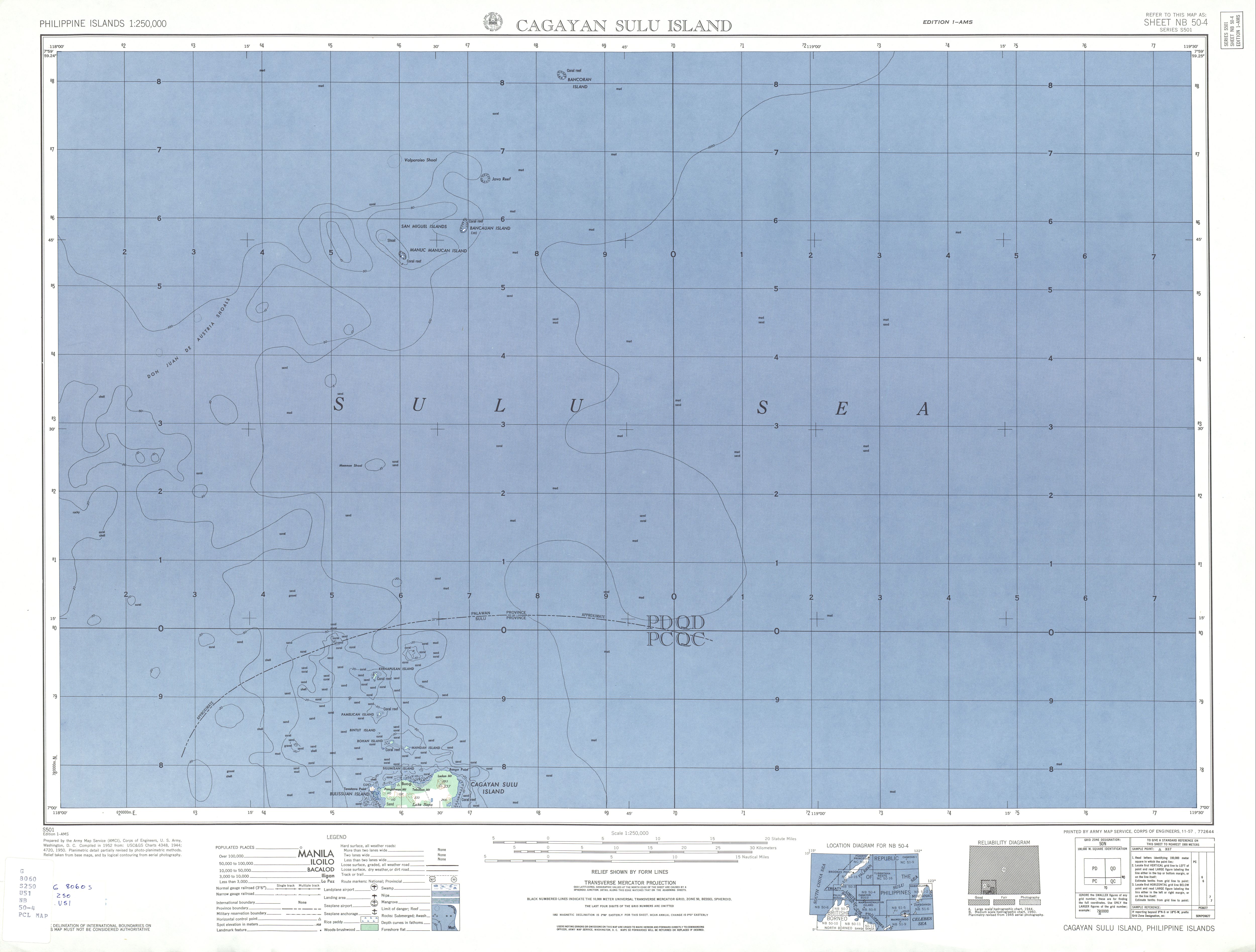
- ↑ Topographic map 1: 250,000, map sheet NB 50-4
- ^ Website of the Mapun community