Palawan
| Basic data | |
|---|---|
| Region : | MIMAROPA |
| Capital : | Puerto Princesa |
| Population : | 849.469 August 1, 2015 census
|
| Population density : | 58 inhabitants per km² |
| Area : | 14,649.7 km² |
| PSGC : | 175300000 |
| Governor : | Jose Chaves Alvarez |
| Official website: | www.palawan.gov.ph |
| structure | |
| - Highly urbanized cities | 1 |
| - provincial cities | 0 |
| - municipalities | 23 |
| - Barangays | 433 (including Puerto Princesa) |
| - electoral districts | 3 |
| Location of Palawan in the Philippines | |

|
|
Coordinates: 9 ° 32 ′ N , 118 ° 24 ′ E Palawan is an island in the west of the Philippines . Together with the surrounding smaller islands and archipelagos, it forms the Philippine province of Palawan in the MIMAROPA region. The largest city and capital is Puerto Princesa .
geography
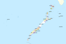
Palawan is stretched out between the South China Sea in the northwest and the Sulu Sea in the southeast. The main island is about 450 km long, on average about 40 km wide and crossed by a mountain range, the highest point of which is Mount Mantalinganhan at 2085 m . The narrowest point, between Ulugan Bay and Honda Bay, measures around 8.5 kilometers. In the northeast the Mindoro Strait separates the province from the island of Mindoro , in the southwest the Balabac Strait from Borneo . The province also includes the Calamian Islands north of the main island , the southern Balabac Islands , the Cagayan and Cuyo Islands in the Sulu Sea and the Philippine-occupied part of the Spratly Islands , Kalayaan . With an area of almost 15,000 km², Palawan is the largest province in the Philippines.
geology
Palawan may belong to a part of the Eurasian plate that drifted southwards as a microplate , which also formed the South China Sea. The islands' karst formations are similar to those in Borneo , southern China and Vietnam . In contrast to the rest of the Philippines, there is no recent volcanism in the province .
climate
Palawan is characterized by an ever-humid tropical climate. Due to northeast trade winds and southwest monsoon winds , the least rainfall falls from November to April, most between June and October. The annual averages for Puerto Princesa are 27.4 ° C, 1607 mm of precipitation and 68.9% relative humidity .
Flora and fauna
Due to the lower sea level during the last ice ages, Palawan was connected several times in the past by land bridges with Borneo and the Asian mainland and was thus part of Sundaland . The islands are therefore by the Huxley-line by the Mindoro Strait and the Sulu Sea runs and the more southerly Wallace Line , connects biogeographically separated from the rest Philippines. Overall, the flora and fauna of Palawan is similar to that of Borneo.
Palawan is characterized by a high degree of biodiversity and endemism . So far known 232 animal species developed, including endemics such as the Palawan rat , the Palawan pangolin or the Palawan peacock pheasant , and 1522 species of flowering plants. The marine habitat is characterized by many coral reefs surrounding the islands ; the Tubbataha Reef is a UNESCO World Heritage Site . In Malampaya Sound , a population living on Irawadidelphinen .
However, the biodiversity on Palawan is threatened by the extremely increasing conversion of large areas into palm oil plantations.
The following endemic species and subspecies are classified as endangered by the World Conservation Union (incomplete):
Protected areas and national parks

There are ten nature reserves and two national parks in Palawan Province. To protect the biodiversity of the island of Palawan, Republic Law 7611 , also known as the Strategic Environmental Plan (SEP) for Palawan Act , was signed by the then President Corazon Aquino in 1991 . This law defines the guidelines on which the environmental policy of the provincial government of Palawan is to be oriented and thus serve the sustainable development of the province. The Palawan Council for Sustainable Development was created as an advisory element of the policy, which draws up annual reports on the state of the province's environment and monitors the implementation of the measures adopted. This law was the prerequisite for declaring the island of Palawan a biosphere reserve in 1991 , one of two model regions in the Philippines. The nature reserves and national parks belonging to the biosphere reserve are administered in accordance with the guidelines of Republic Law 7586 , the National Integrated Protected Areas System Act of 1992 .
Protected areas:
- Calauit Game Preserve and Wildlife Sanctuary
- Coron Island Protected Area
- Culasian Managed Resource Protected Area, Rizal
- El Nido-Taytay Managed Resource Protected Area
- Malampaya Sound Protected Landscape / Seascape
- Mount Mantalinganhan Protected Landscape
- Omoi and Manambaling Cockatoo Reserves, Dumaran
- Port Barton Marine Park
- Rasa Island Wildlife Sanctuary
- Ursula Island Game Refuge and Bird Sanctuary
National parks:
history
In 1962, human bones and tools were found in the Tabon Caves ( Quezon municipality , South Palawan), which are the oldest traces of humans in the province, at least 16,500 years old .
Chinese sources from the time of the Southern Song Dynasty (1127–1279) document trade relations between Palawan and China . During the reign of Sultan Bolkiah (1485-1524) Palawan came under the rule of the Sultanate of Brunei , later the Sultanate of Sulu . Sources speak of the cession of territory by the Sultans of Sulu and Maguindanao to the Spanish East Indies in 1705. Most recently, in 1749, Brunei renounced territorial claims.
During the colonial period, the main island was also called Paragua , possibly because its shape resembles a folded umbrella (span. Paraguas ).
As early as 1591 there was an encomienda on the Calamian Islands. From 1622 the Augustinian order began to build fortified mission stations on the Cuyo Islands and northern Palawan, including in Taytay . By 1818 at the latest, the province of Calamianes existed with the capital Taytay, which included the Calamian, Cuyo and Cagayan Islands and the northern part of the main island up to about the 10th parallel. In 1858 the province included the whole of Palawan with the districts of Castilla in the north and Asturias in the south. In 1862 the Asturias district was separated from Calamianes as an independent province of Paragua . The administrative seat was initially Taytay, from 1873 Cuyo . The province of Palawan in its current form with the capital Puerto Princesa was approved by the US civil administration with Commission Act No. Established in 1363 1905.
During the Second World War , Palawan was under Japanese occupation from 1941 to 1945.
Separatist groups like the MILF are striving to incorporate Palawan into a future Moroland . In a referendum in 2001, however, over 98 percent of the population spoke out against joining the already existing Muslim Mindanao autonomous region .
population
Traditionally, a distinction is made between two population groups:
- Indigenous ethnic groups such as the Tagbanuwa and Negritic Batak in central and northern Palawan and the Palawanos and Molbog in the south
- The Palaweños , descendants of later Filipino immigrants, most of them from the Cuyo Islands (so-called Cuyonons )
The individual population groups speak their own Filipino languages and dialects with Tagalog as the main and lingua franca ; the Tagbanuwa developed their own writing system . The people are predominantly Roman Catholic or, to a lesser extent, of other Christian faiths. In the extreme south (communities Balabac and Bataraza ) Islam dominates.
Population development since 1990:
| 1990 | 2000 | 2010 | |
|---|---|---|---|
| Palawan (excluding Puerto Princesa) | 436.140 | 593,500 | 771,667 |
| Puerto Princesa | 92.147 | 161,912 | 222,673 |
| total | 528.287 | 755.412 | 994.340 |
Economy and Infrastructure
31% of the land area is used for growing rice , wheat , corn , bananas , cassava , elephant grass , cashew nuts and peanuts . In addition to fishing, the wood, copra and palm oil industries also play a role. Chromite and nickel are the main mined mineral resources . The indigenous organization ALDAW ( Ancestral Land / Domain Watch ) fears environmental damage (including deforestation ) due to the expansion of nickel mining and palm oil production. In the South China Sea oil and gas reserves are exploited, Palawan making it the only oil-producing province of the Philippines.
From Puerto Princesa there are regular ferries via Coron to Manila and via Cuyo to Iloilo . The main tourist centers are Puerto Princesa, Coron and El Nido. In addition to the international airport Puerto Princesa ( IATA code : PPS) there are other, smaller domestic airports and landing strips, of which the larger ones are in Coron (USU), Culion (CUJ), El Nido (ENI) , Magsaysay (CYU), Rizal ( TGB) and Taytay (RZP).
Administrative division
The province of Palawan is divided into 23 parishes and three congressional districts ( legislative or congressional districts).
|
First Congress District: |
Second Congress District: |
Third Congress District:
|
Colleges
Individual evidence
- ↑ Hogan, Saundry: South China Sea . In: Encyclopedia of Earth . Retrieved December 23, 2012.
- ↑ climatemps.com . Retrieved December 23, 2012.
- ↑ In the Philippines, eight million hectares of land are to be converted into palm oil plantations. Rettet den Regenwald eV Accessed May 12, 2015
- ↑ The Republic Act 7611 (English)
- ↑ Website of the Palawan Council for Sustainable Development (English)
- ↑ The Palawan Bioshere Reserve (English; PDF; 3.5 MB) UNESCO Working Paper No. 19, 1997
- ↑ Protected Areas in Region 4B - MIMAROPA ( Memento of the original from October 29, 2013 in the Internet Archive ) Info: The archive link was inserted automatically and has not yet been checked. Please check the original and archive link according to the instructions and then remove this notice. (English) Website of the PAWB (Protected Areas and Wildlife Bureau)
- ^ F. Détroit et al., CR Palevol 3: Upper Pleistocene Homo sapiens from the Tabon cave (Palawan, The Philippines): description and dating of new discoveries (PDF; 370 kB) Académie des sciences. 2004. Retrieved December 23, 2012.
- ↑ Wang Zhenping: Reading Song-Ming Records on the Pre-colonial History of the Philippines (PDF; 223 kB) Accessed December 23, 2012.
- ^ Josiah C. Ang, PM: Historical Timeline of the Royal Sultanate of Sulu Including Related Events of Neighboring Peoples . Retrieved December 23, 2012.
- ^ The Provincial Profile of Palawan . Retrieved December 23, 2012.
- ^ Wernstedt, Spencer: The Philippine Island World: A Physical, Cultural, and Regional Geography . University of California Press. 1967. Retrieved October 16, 2013.
- ↑ Nilo S. Ocampo: Katutubo, Muslim, Kristyano: Palawan, 1621-1901 . In: Journal of Southeast Asian Studies, Volume 21, Issue 02 . Cambridge University Press 1990. 1985. Retrieved October 16, 2013.
- ^ Charles Knight : Philippines . In: The Penny Cyclopædia of the Society for the Diffusion of Useful Knowledge, Volume XVIII . London, 1840. Retrieved October 16, 2013.
- ^ Environment Department of El Nido Resorts . Retrieved December 23, 2012.
- ↑ 2001 ARMM Plebiscites Results . Commission On Elections. Retrieved December 23, 2012.
- ↑ Population and Annual Growth Rates for The Philippines and Its Regions, Provinces, and Highly Urbanized Cities (PDF; 29 kB) In: 2010 Census and Housing Population . National Statistics Office. Retrieved December 23, 2012.
- ↑ http://www.iucn.org/about/union/commissions/ceesp/ceesp_news/?4631/
- ↑ http://www.iucn.org/about/union/commissions/ceesp/ceesp_news/?6591/


