
Cagayancillo
| Municipality of Cagayancillo | |||
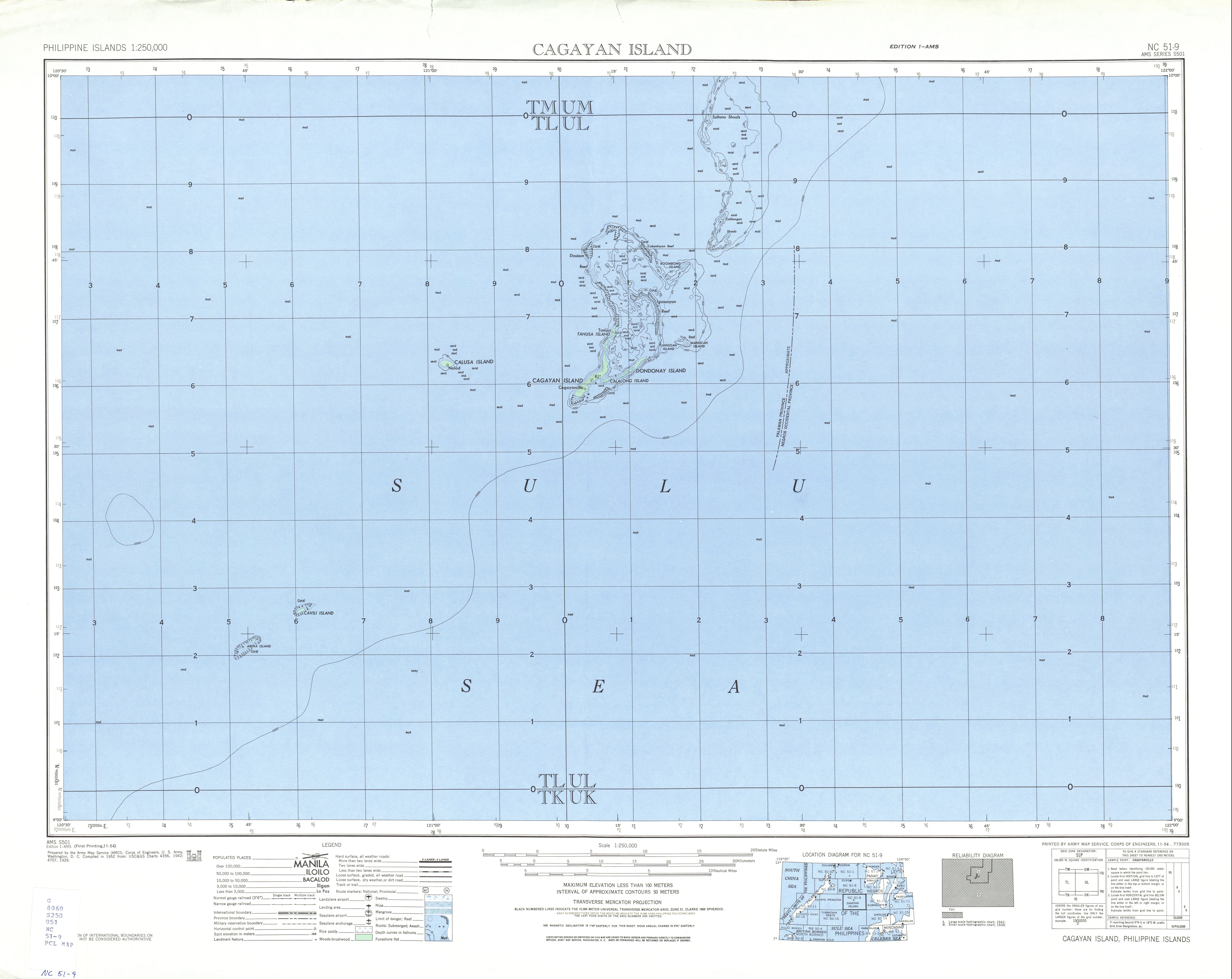
| Location of Cagayancillo in the province of Palawan | |||
|---|---|---|---|

|
|||
| Basic data | |||
| Region : | Western Visayas | ||
| Province : | Palawan | ||
| Barangays : | 12 | ||
| District: | 1. District of Palawan | ||
| PSGC : | 175308000 | ||
| Income class : | 5th income bracket | ||
| Households : | 947 May 1, 2000 census
|
||
| Population : | 6,285 August 1, 2015 census
|
||
| Population density : | 238.2 inhabitants per km² | ||
| Area : | 26.39 km² | ||
| Coordinates : | 9 ° 35 ' N , 121 ° 12' E | ||
| Postal code : | 5321 | ||
| Geographical location in the Philippines | |||
|
|||

Cagayancillo is a Filipino municipality in the province of Palawan . It has 6,285 inhabitants (August 1, 2015 census). In addition to the main island of Cagayan, the municipality also includes Calusa Island (18 kilometers to the west, belonging to the Barangay Magsaysay) and the Tubbataha reef, 123 kilometers to the southwest .
Barangays
Cagayancillo is politically divided into twelve barangays .
|
|
|
Individual evidence
- ↑ Administrative map ( page no longer available , search in web archives ) Info: The link was automatically marked as defective. Please check the link according to the instructions and then remove this notice.