Castro Urdiales
| Castro Urdiales municipality | ||
|---|---|---|
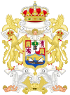
| coat of arms | Map of Spain | |

|
|
|
| Basic data | ||
| Autonomous Community : |
|
|
| Coordinates | 43 ° 23 ′ N , 3 ° 14 ′ W | |
| Area : | 96.70 km² | |
| Residents : | 32,069 (Jan. 1, 2019) | |
| Population density : | 331.63 inhabitants / km² | |
| Municipality number ( INE ): | 39020 | |
| administration | ||
| Website : | www.castro-urdiales.net | |
| Location of the municipality | ||

|
||
Castro Urdiales is a city in the Spanish autonomous region of Cantabria .
Geography and climate
The city is the capital of the municipality of the same name ( Municipio ), it is located on the Costa Oriental and is the third largest city in Cantabria. Thanks to its location on the Bay of Biscay , the maritime weather is moderate : humid, with cool summers and mild winters.
Community structure
In addition to the eponymous capital, the following places belong to the community of Castro Urdiales: Allendelagua, Baltezana, Cerdigo, Islares, Lusa, Mioño, Ontón, Oriñón, Otanes, Sámano, Santullán, Sonabia and Talledo.
history
Numerous rock paintings in caves indicate a prehistoric settlement. Pliny the Elder mentions in his Naturalis historia a place called Portus Amanus (port of the Amans ) and the Castrum Vardulies (camp of the Vardulians ). In 74 AD, the Roman colony Flaviobriga was founded in the area of both places and named after Vespasian .
Attractions
- Church of Santa Maria
- Santa Ana Fortress
Famous sons and daughters of the city
- Ataúlfo Argenta (1913–1958), pianist and director of the Spanish National Orchestra
- Eladio Laredo (1864–1941), architect
- Pedro Zaballa (1938–1997), football player
- Ricardo Cortés Lastra (* 1969), politician
- Eladio Sánchez (* 1984), racing cyclist
Web links
Individual evidence
- ↑ Cifras oficiales de población resultantes de la revisión del Padrón municipal a 1 de enero . Population statistics from the Instituto Nacional de Estadística (population update).


