Cenote Angelita
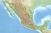
Coordinates: 20 ° 8 ′ 15 " N , 87 ° 34 ′ 40" W.
The Cenote Angelita ( Spanish ;) is a doline- like limestone hole that was created by the collapse of a cave ceiling and is filled with fresh water.
description
The term comes from the Maya of the Mexican peninsula Yucatán and means sacred spring ( Mayathan ts'ono'ot ). In the present case, the Mayathan is mixed with the Spanish word "Angelita" meaning "little angel".
The cenote is located in a jungle away from the ruins of the Mayan city of Tulum in Mexico . The crater is about 60 meters deep and was once a sacred place for the Maya. The crater has different levels of salinity in different places. And, since the water sinks with a higher density , an underwater river runs in the different water layers near the bottom.
Individual evidence
- ↑ Huber: Gate to the Underworld
- ↑ A River ... Underwater. Retrieved March 12, 2020 .
literature
- Florian Huber : Gateway to the Underworld. In: Hörzu.Wissen, No. 1 February / March 2014, p. 31ff.
- Joshua Foer, Dylan Thuras, Ella Morton: Atlas Obscura; Page 424; First edition October 2017
