Chegga
| Chegga | ||
|---|---|---|
|
|
||
| Coordinates | 25 ° 22 ′ N , 5 ° 47 ′ W | |
| Basic data | ||
| Country | Mauritania | |
| Tiris Zemmour | ||
| ISO 3166-2 | MR-11 | |
| height | 365 m | |
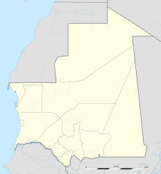
Chegga is a city in northeast Mauritania , near the border with the neighboring states of Algeria and Mali in the Tiris Zemmour region . The city is about 365 m above sea level.
The most important road to western Mauritania runs through Malian territory, with another road leading to Bir Moghrein in northern Mauritania, 900 kilometers to the west . The oasis Chegga has for centuries been an important place for caravans and is also used as a military outpost. The city's main attraction is a fort .
Individual evidence
- ^ Hein and Wil de Vries website: Chegga - Mauritania. Retrieved March 19, 2018 .
- ↑ LookLex / Mauritania / Chegga. Retrieved March 19, 2018 .
