Ciudad López Mateos
| Ciudad López Mateos | ||
|---|---|---|
|
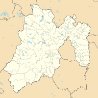
Coordinates: 19 ° 33 ′ N , 99 ° 17 ′ W Ciudad López Mateos on the map of Mexico
|
||
| Basic data | ||
| Country | Mexico | |
| State | México | |
| Municipio | Atizapán de Zaragoza | |
| Residents | 560,500 (2019) | |
| Detailed data | ||
| surface | 91.1 km² | |
| height | 2280 m | |
| view on the city | ||
Ciudad López Mateos is a city in the Mexican state of México and the seat of the Municipio Atizapán de Zaragoza . It is part of the Zona Metropolitana del Valle de México . The city was previously called San Francisco Atizapán , but the official name was changed after President Adolfo López Mateos , who was born in this city. However, the city is still commonly known as Atizapán . It had 489,160 inhabitants according to the 2010 census. For 2019, the population was estimated at 560,500. It is the sixth largest city in the state.
Since this was the hometown of former Mexican President Adolfo López Mateos, a mausoleum was built in the city center for his remains.
geography
Three rivers cross Atizapán: the Tlalnepatla River, the San Javier River, and the Moritas River, all of which are north of the municipality.
In Atizapán, near the border with Naucalpan, is the Madin Dam, which supplies water to the northwestern part of the greater Mexico City area .
Various rivers flow through Atizapán, including "La Bolsa", "La Herradura", "El Tecojote" and "El Xhinte".
On the west side of the city is the Zona Esmeralda neighborhood, which is considered one of the richest in the state of Mexico and in the greater Mexico City area.
Infrastructure
Although none of the major highways in Greater Mexico City have stations in Atizapán, many bus routes cross Atizapán and operate mainly in the northern, central and southwestern parts of Mexico.
At the beginning of the 20th century, a railway line called "Montealto" ended in Atizapán.
In the northern part of Atizapán there is an airport that has minimal use as there are no airlines.
In addition, a motorway runs through Atizapán and serves to connect it with the capital of the state of Mexico Toluca de Lerdo , the districts of Interlomas , Santa Fe and Herradura as well as the Mexico-Querétaro motorway.
sons and daughters of the town
- Adolfo López Mateos (1910–1969), politician
Individual evidence
- ↑ México (Mexico): State & Cities - Population Statistics, Maps, Charts, Weather, and Web Information. Retrieved February 3, 2020 .
- ^ San Francisco Atizapán. Retrieved February 3, 2020 .
- ↑ Zona Esmeralda, el lugar más seguro para vivir en México. August 26, 2011, accessed February 3, 2020 (Spanish).

