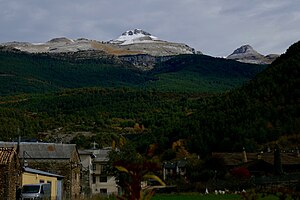
Collarada
| Collarada | ||
|---|---|---|
|
The Collarada as seen from Villanúa |
||
| height | 2886 msnm | |
| location | Huesca Province , Spain | |
| Mountains | Pyrenees | |
| Coordinates | 42 ° 40 '50 " N , 0 ° 28' 14" W | |
|
|
||
The Collarada is a mountain peak in the Pyrenees in Spain with an altitude of 2886 m. It is located in the municipality of Villanúa in the province of Huesca in the Aragon region . Rs is the highest mountain in the comarca (district, district) Jacetania and one of the most impressive Pyrenean peaks because of its wide visibility.
The Collarada belongs to the inner mountains of the Pyrenees and is part of the Circo de Ip (a summit circle), in the middle of which is the glacial lake of Ip.
The mountain is made of limestone , which through time, glaciation and water means that a complex karst system of caves, holes and pits has formed in it and is shaped by the water that affects them in the form of rivers, lakes and seepage , further changed.
Within the karst formations of the Collarada, the touristic accessible cave Las Güixas (“grutas viejas” = old grottos), the Cándalo spring, the Vernero pit and the hells ( infierno ) or Buxaquera pit are of particular importance. The latter is located at an altitude of 2500 m and has a depth of 714 m.

