Copargo
| Copargo | ||
|---|---|---|
|
|
||
| Coordinates | 9 ° 52 ′ N , 1 ° 30 ′ E | |
| Basic data | ||
| Country | Benin | |
| Donga | ||
| ISO 3166-2 | BJ-DO | |
| height | 495 m | |
| surface | 876 km² | |
| Residents | 70,938 (2018) | |
| density | 81 Ew. / km² | |
| politics | ||
| mayor | Ignace Ouorou | |
|
Place-name sign
|
||
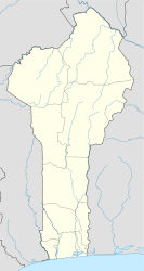
Copargo is a municipality in the northwest of Benin in the Donga department .
geography
The municipality extends over 876 km² and is bordered by the municipalities of Kouandé (in the north), Djougou (in the south and east) and Ouaquè (in the west). Moreover Copargo bordered to the west by Togo .
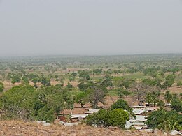
The landscape is dominated by the foothills of the Atakora mountain range . The rest of the community area is flat. Two seasons determine the climate: the rainy season from mid-April to mid-October and the dry season (mid-October to mid-April). The amount of rain varies between 800 mm and 1300 mm, the peak is measured around 1500 mm, most rainfall occurs in August and September. There are some small rivers in the municipality (mainly during the rainy season): Affèou, Yari, Gbangbaré, Saguigui.
population
70,938 people live in Copargo (as of 2018), which corresponds to a population density of 85 people per km². Members of the Tanéka (Yom) and Lokpa represent 83% of the population. Other ethnic groups are Fulbé (7.2%), Hausa (1.4%) as well as Sola, Boufalé, Bariba and Fon . The traditional religions (including Voodoo) are practiced by 70% of the population, in addition there are 18% Muslims and 8% Christians.
Administrative organization
The municipality is divided into four administrative districts, Anandana, Copargo, Pabégou and Singré; these districts include 46 villages and the central town of Copargo. Mayor is Monsieur Ignace Ouorouu, Alderman are Louis Konde and Imaorou Ambani.
Infrastructure
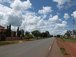
The paved trunk road from the coast to Burkina Faso runs through the municipality for about 20 km . The remaining connections are partly very bad slopes, some of which are impassable during the rainy season. Electricity is only available in Pabégou, Copargo and Singré (since 2011). Open wells, water holes, small water runners and individual closed wells with pumps ensure the water supply. Only in Copargo and Singré are there two elevated water tanks and thus running water for public buildings and a small part of the respective population.
There are 79 primary schools, some of which are in a disastrous structural condition. In Copargo and in Pabégou there is a CEG at which it is possible to graduate with the Abitur.
A hospital managed by Salissou Atta ensures medical care. In addition, there are five health centers, Pabégou, Copargo, Singré, Anandana and Kpassabia, which are also under the direction of Fabien N'tia.
Copargo still has its own police station and post office.
Partnerships
An intensive town partnership has existed since 2006 with the Saarland community of Losheim am See . In 2010 the community signed a partnership with the Development Aid Benin eV The partnership has a term of 10 years. In 2005, the CEG in Copargo entered into a partnership with the Peter Dewes Comprehensive School in Losheim am See. In 2010 the CEG in Pabégou and the oak foliage school in Weiskirchen also signed a school partnership.
Web links
- ( Page no longer available , search in web archives ) City partnership Copargo - Losheim
Individual evidence
- ↑ Saarbrücker Zeitung: Help for Copargo continues. Retrieved February 13, 2018 .


