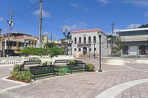
Corozal (Puerto Rico)
| Corozal | |
|---|---|
| Nickname : La Capital del Voleibol; Los Plataneros | |
 Place in Corozal |
|
 flag |
|
| Location in Puerto Rico | |
| Basic data | |
| Foundation : | 1795 |
| State : | United States |
| Outside area : | Puerto Rico |
| Coordinates : | 18 ° 21 ′ N , 66 ° 19 ′ W |
|
Inhabitants : - Metropolitan Area : |
32,320 (status: 2018) 2,617,089 (status: 2009) |
| Population density : | 296.5 inhabitants per km 2 |
| Area : | 109 km 2 (approx. 42 mi 2 ) of which 109 km 2 (approx. 42 mi 2 ) are land |
| Postal code : | 00783 |
| Area code : | +1 787 |
| GNIS ID : | 1804503 |
Corozal is a city in Puerto Rico and is also one of the 78 parishes of Puerto Rico. The city is located in the middle of the outskirts of the United States and has a population of 32,320 (2018 estimate).
Individual evidence
- ↑ Corozal Municipio, Puerto Rico , factfinder.census.gov, accessed April 20, 2019 (English)
