Crown Prince Frederik Island
| Crown Prince Frederik Island | ||
|---|---|---|
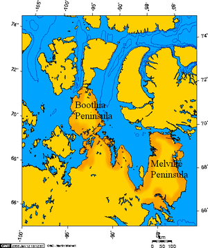
| Crown Prince Frederik Island is northwest of the Melville Peninsula | ||
| Waters | Gulf of Boothia | |
| Archipelago | Canadian Arctic Archipelago | |
| Geographical location | 70 ° 2 ′ N , 86 ° 50 ′ W | |
|
|
||
| length | 35 km | |
| width | 16 km | |
| surface | 401 km² | |
| Highest elevation | 110 m | |
| Residents | uninhabited | |
Crown Prince Frederik Iceland is an island of the Canadian Arctic Archipelago- in the Qikiqtaaluk Region of the Canadian territory of Nunavut . It is located off the south coast of West Baffin Island and west of the Fury and Hecla Strait in the Gulf of Boothia .
The land area is 401 km². The island has an east-west extension of 35 km. The maximum width is 16 km. The highest point on the island reaches 110 m.
The easternmost point on the island is called Point Kendall .
Web links
- Crown Prince Frederik Island ( memento from July 19, 2011 in the Internet Archive ) in the island encyclopedia www.oceandots.com (English)
Individual evidence
- ↑ The Atlas of Canada - Sea Islands ( Memento from October 6, 2012 in the Internet Archive ) (English)
- ↑ UN SYSTEM-WIDE EARTHWATCH Web Site - Crown Prince Frederik

