Fury and Hecla Street
| Fury and Hecla Street | ||
|---|---|---|
| Connects waters | Gulf of Boothia | |
| with water | Foxe Basin | |
| Separates land mass | Baffin Island | |
| of land mass | Melville Peninsula | |
| Data | ||
| Geographical location | 69 ° 54 ′ N , 84 ° 17 ′ W | |
|
|
||
| length | 70 km | |
| Smallest width | 2 km | |
| Islands | Ormonde Island, Elder Island | |
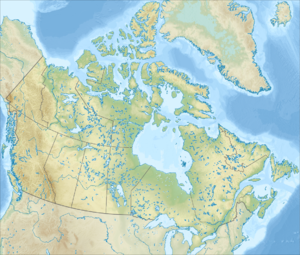
The Fury and Hecla Strait ( English Fury and Hecla Strait ) is a strait in Nunavut, Canada . It separates the largest island in the country, Baffin Island , from the mainland, more precisely from the Melville Peninsula . The waterway is about 160 km long and up to 35 km wide. At the east end there are several islands in the Fury and Hecla Straits. Here, between Ormonde Island and the Canadian mainland, there is also the narrowest part of the strait at just 2 km. The water is icy most of the year.
The waterway was discovered in 1822 during William Edward Parry's second expedition and named after his two ships, the HMS Fury and the HMS Hecla .
The most important place in the region is Iglulik on an island a little southeast of the Fury and Hecla Strait.
