Rasmussen Basin
| Rasmussen Basin | ||
|---|---|---|
|
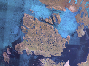
Satellite photo of King William Island with the Rasmussen Basin (bottom right) |
||
| Waters | Arctic Ocean | |
| Land mass | mainland North America, King William Island | |
| Geographical location | 68 ° 30 ′ N , 94 ° 52 ′ W | |
|
|
||
| width | 100 km | |
| depth | 75 km | |
| Islands | Hovgaard Islands | |
| Tributaries | Murchison River , Inglis River , Castor and Pollux River | |
The Rasmussen Basin ( Inuktitut Kangilliniq ) is a bay of mainland North America in the Kitikmeot region of the Nunavut territory of Canada .
geography
The Rasmussen Basin is located southeast of King William Island along the coast of mainland North America. It is connected to St. Roch Base via Rae Strait in the north and the Queen Maud Gulf via Simpson Strait to the west . The Chantrey Inlet connects to the south . With the exception of the Hovgaard Islands off the coast of King William Island, the Rasmussen Basin has no larger islands. On the northwestern bank of the basin on King William Island is Gjoa Haven with over 1000 inhabitants.
From the beginning of October to the second half of July, the water is covered by fast ice, which is usually between 1.80 and 2.20 m thick.
history
When crossing the Northwest Passage for the first time, the expedition, led by Roald Amundsen, wintered twice with their ship Gjøa in the Rasmussen Basin bay Gjoa Haven from 1903 to 1905 .
literature
- Donat Pharand, Leonard H. Legault: The Northwest Passage. Arctic Straits . Martinus Nijhoff Publishers, Dordrecht 1984, ISBN 90-247-2979-3 , p. 16-17 ( limited preview in Google Book search).
Individual evidence
- ↑ Darren Keith: Inuit Qaujimaningit Nanurnut Inuit Knowledge of Polar Bears (PDF; 7.0 MB). Gjoa Haven Hunters 'and Trappers' Organization and CCI Press, 2005, Appendix 5.
Web link
- Rasmussen Basin in the Atlas of Canada

