McClintock Canal
| McClintock Canal | ||
|---|---|---|
| Connects waters | Viscount Melville Sound | |
| with water | Larsensund | |
| Separates land mass | Prince of Wales Island | |
| of land mass | Victoria Island | |
| Data | ||
| Geographical location | 71 ° 41 ′ N , 102 ° 13 ′ W | |
|
|
||
| length | 271 km | |
| Smallest width | 105 km | |
| Islands | Gateshead Island | |
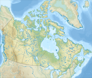
The McClintock Channel ( English M'Clintock Channel ) is an extension of the Arctic Ocean in the Canadian territory of Nunavut . It is located in the Canadian Arctic Archipelago , between Victoria Island and Prince of Wales Island . The canal is 274 km long and 105 to 209 km wide and connects the Viscount-Melville-Sund in the north with the Larsensund in the south.
The strait was named after the polar explorer Francis McClintock and belonged to the former Franklin district .
