Bellotstrasse
| Bellotstrasse | ||
|---|---|---|
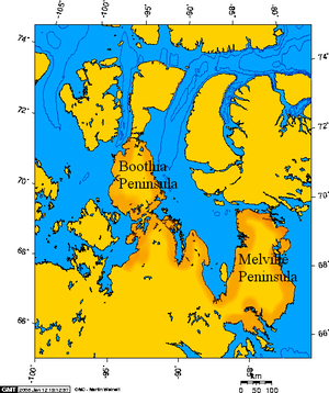
| The Bellot Strait separates the Boothia Peninsula (outlined in red) in the north from Somerset Island | ||
| Connects waters | Gulf of Boothia to the east | |
| with water | Franklinstrasse in the west | |
| Separates land mass | Somerset Island | |
| of land mass | Boothia Peninsula ( Mainland Canada ) | |
| Data | ||
| Geographical location | 72 ° 0 ′ N , 94 ° 48 ′ W | |
|
|
||
| length | 35 km | |
| Smallest width | 2 km | |
The Bellot Strait is a strait between the American continent and the island of Somerset in the Canadian Arctic Archipelago .
It was discovered in 1851/52 by William Kennedy and the French naval officer Joseph-René Bellot , who accompanied him on his search expedition to John Franklin , after whom it was named. Bellotstrasse is a core part of the Northwest Passage . It connects the Gulf of Boothia with the Peelsund and the Franklin Strait between the Boothia peninsula in the south and Somerset Island in the north. Their geographical position is roughly 72 ° 00'N and 94 ° 30'W; Zenith Point , the northernmost point on the mainland, is at 72 ° 00.1'N.
At the eastern entrance to Bellot Strait from the Gulf of Boothia, there are two remaining houses on Somerset Island from Fort Ross, an outpost of the Hudson's Bay Company that was only active between 1937 and 1948 and which also took the ship route from the west with the ship Aklavik in 1937 drove through.
Belcher column and Bellot memorial site (mock grave)


