Dam Lake
| Dam Lake | ||
|---|---|---|

|
||
| Jezioro Dąbie | ||
| Geographical location | Szczecin , Poland | |
| Tributaries | Or , Płonia , Ihna | |
| Drain | Or | |
| Places on the shore | Stettin , Police (Pölitz) | |
| Data | ||
| Coordinates | 53 ° 27 '57 " N , 14 ° 39' 11" E | |
|
|
||
| surface | 56 km² | |
| Maximum depth | 8 m | |
| Middle deep | 3.0-3.5 m | |
|
particularities |
protrudes into the urban area |
|
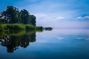
The Dammsche See ( Polish Jezioro Dąbie ) is a widening of the Oder shortly before its mouth. The lake, which is around 15 kilometers long and at its widest point around four kilometers wide, begins in the inner city of Szczecin , where the lowland, which is shaped by many river arms and islands, turns into an open lake. The river returns to its bed just above the town of Pölitz ( Police ), but spreads out again just before it flows into the Stettiner Haff ( Papenwasser / Roztoka Odrzańska ).
The name of the lake comes from the town of Altdamm on the eastern bank of the Oder, now a district of Szczecin.
In addition to the two main branches of the Oder, the West and East Oder, and the cross-connections Dunzig and Parnitz , the rivers Plöne ( Płonia ) and Ihna ( Ina ) flow into the Dammschen Lake. Separated from the rest of the lake by several large islands, the west or in the area of the lake largely maintains its course.
The western shore of the lake is densely built up with the districts of Szczecin, in the south the large seaport of the city separates the Dammschen See from the landscape protection park Unteres Odertal , in the southeast lies the aforementioned district Altdamm. The eastern and northern banks are largely uninhabited, the next town ( Gollnow / Goleniów ) is around 10 km to the east.
photos
Satellite image of the Dammschen lake


