Dededo
| Dededo | ||
|---|---|---|
|
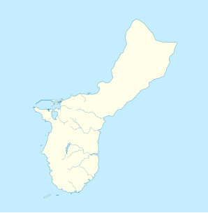
Location on Guam
|
||
| Basic data | ||
| State : | United States | |
| Outside area : | Guam | |
| Coordinates : | 13 ° 31 ′ N , 144 ° 50 ′ E | |
| Time zone : | Chamorro Time Zone ( UTC + 10 ) | |
| Residents : | 44,943 (as of 2010) | |
| Population density : | 578.4 inhabitants per km 2 | |
| Area : | 77.7 km 2 (approx. 30 mi 2 ) | |
| Height : | 91 m | |
| Area code : | +1 671 | |
| FIPS : | 66-27400 | |
| GNIS ID : | 1389637 | |
| Website : | www.dededo.org | |
| Mayor : | Melissa B. Savares | |
With 45,000 inhabitants, Dededo is the most populous settlement on Guam and its school center.
Dededo is located in the northern part of the Pacific island.
history
Before the Second World War , the place was at the foot of Macheche Hill on road 16. After the village was destroyed in the war, the Naval Government settled the residents at the current location. In 1962, Typhoon Karen destroyed most of the wooden houses that had been typical of the area up until then. With the help of the authorities, new buildings were built for the families.
Surname
The name of the former village Dededo can be traced back to two meanings, although there is no agreement which is true.
- Dededo means something like two fingers in an old system of measurement that is no longer in use.
- The name may also come from the term dedeggo , which describes a person who moves quietly on tiptoe.
structure
Dededo is divided into several areas and parts. This includes:
- Liguan Terrace, Emperor, Y-Paopao,
- Sagan Y-Papao, Astumbo, Fern Terrace
- Harmon Gardens, Harmon Court, Macheche Village,
- Benson Village, Standard Group, Finegayan,
- Ukudo, Asadas and Knowledgeable.
Web links
Commons : Dededo, Guam - collection of images, videos and audio files
Individual evidence
- ^ The Story Behind The Name ( Memento June 6, 2007 in the Internet Archive )
