Deji Dam
| Deji Dam | |||||
|---|---|---|---|---|---|
| The arch dam | |||||
|
|||||
|
|
|||||
| Coordinates | 24 ° 14 '6 " N , 121 ° 4' 37" E | ||||
| Data on the structure | |||||
| Construction time: | 1969–1974 (?) | ||||
| Height above foundation level : | 181 m | ||||
| Crown length: | 285 m | ||||
| Power plant output: | 234 MW | ||||
| Data on the reservoir | |||||
| Altitude (at congestion destination ) | 1410 m | ||||
| Water surface | 4.53 km² | ||||
| Reservoir length | 14 km | ||||
| Storage space | 148 million m³ | ||||
| Total storage space : | 195 million m³ | ||||
| Catchment area | 592 km² | ||||
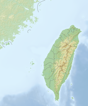
The Deji Dam ( Chinese 德基 水庫 ) is located on the Dajia River in central Taiwan . The name can also be found written as "Tehchi" or "Tachien". The reservoir was created between 1969 and 1974. At 1408 m above sea level , it is said to be the highest reservoir in Asia.
Deji Reservoir is located at the foot of Li Mountain ( 梨山 , Líshān ) in the Heping District of Taichung City in a very scenic area. It is the top of several reservoirs on Dajia. The Shigang Dam , which became famous when it was destroyed in the 1999 Jiji earthquake, is located on this river .
The storage space of Deji Reservoir is three times the size of that of Sun Moon Lake , the largest natural lake in Taiwan. The dam has a 181 m high arch dam as a barrier structure . The arch dam has a hyperbolic curve and is 285 meters long.
The resulting reservoir is 14 kilometers long and has an area of 453 hectares when fully blocked . The total storage volume was quantified in November 2014 with 194,687,000 m³ (0.195 km³) and the effective storage volume with 148,754,000 m³ (figures according to the Taiwanese authority for water resources).
See also
- List of the largest dams on earth
- List of the largest reservoirs on earth
- List of power plants in Taiwan
- List of dams in the world (Taiwan)
Web links
- Lishan: Tehchi Reservoir ( Memento from November 10, 2005 in the Internet Archive )
- Deji Tehchi
- Postage stamp: Techi Dam on the Tachia River ( Memento of March 11, 2005 in the Internet Archive )
Individual evidence
- ↑ 公務 統計 報表: 現有 水庫 概況 ("Official statistics report: overview of the existing reservoirs"). Taiwan Ministry of the Interior, accessed December 24, 2018 (Chinese, 106 年 = year 2017).

