Dewas (state)
| Dewas junior | |||||
| 1728-1948 | |||||
|
|||||
| Capital | Dewas | ||||
| Form of government | Princely state (15 rounds salute) | ||||
| surface | 1085 km² | ||||
| population | 55,000 (1901) | ||||
| founding | 1728 | ||||
| resolution | June 15, 1948 | ||||
| State religion: Hinduism Dynasty: Puar Maratha |
|||||
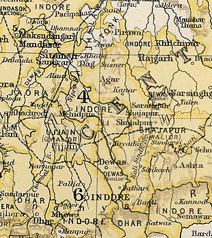
| Map excerpt from The Imperial Gazetteer of India | |||||
| Dewas senior | |||||
| 1728-1948 | |||||
|
|||||
| Capital | Dewas | ||||
| Form of government | Princely state (15 rounds salute) | ||||
| surface | 1163 km² | ||||
| population | 62,000 (1901) | ||||
| founding | 1728 | ||||
| resolution | June 15, 1948 | ||||
| State religion: Hinduism Dynasty: Puar Maratha |
|||||
Dewas was one of the princely states of the Central India Agency of British India in what is now Madhya Pradesh . It was created during the conquest of the Malwa region by the Marathas and was founded by two followers of the Peshwa in 1728: the brothers Tukojirao I. Puar and Jivajirao Puar divided the principality among themselves. This division was retained by their heirs, so that a dual state Dewas Senior / Dewas Junior existed. The capital Dewas was also divided. Both principalities were British protectorates from 1818 to 1947 and both Rajas were raised to Maharajas in 1918 .
The territory of the dual state consisted of several separate parts. Of these, Dewas Senior had 1163 km² and 62,000 inhabitants, Dewas Junior 1085 km² and 55,000 inhabitants (1901). Both maharajas joined India on June 15, 1948 and joined the Madhya Bharat Princely Union on June 16 . On November 1, 1956, all princely states of the Union were dissolved and incorporated into the state of Madhya Pradesh .
See also
literature
- William Barton: The princes of India . With a Chapter on Nepal. Nisbet, London 1934, (Reprinted edition. Cosmo, New Delhi 1983).
- Dewās States. In: The Imperial Gazetteer of India. Volume 11: Coondapoor to Edwardesābād. New Edition. Clarendon Press, Oxford 1908, pp. 277-281 .
- George B. Malleson: An historical sketch of the native states of India. Longmans, Green & Co., London 1875, ( digitized version ).
- Paul E. Roberts: India (= A Historical Geography of the British Dominions. Vol. 7, Part. 1-2). 2 volumes (Vol. 1: History to the End of the East India Company. Vol. 2: History under the Government of the Crown. ). Clarendon Press, Oxford 1916-1923, (Reprinted edition: Historical Geography of India. 2 volumes. Printwell, Jaipur 1995).
- Joseph E. Schwartzberg (Ed.): A historical atlas of South Asia (= Association for Asian Studies. Reference Series. 2). 2nd impression, with additional material. Oxford University Press, New York NY et al. 1992, ISBN 0-19-506869-6 .


