
Dinosaur plate from Lommiswil

The Lommiswil dinosaur slab is a rock slab in a quarry near Lommiswil on the soil of the municipality of Oberdorf SO in Switzerland , which has several well-preserved footprints of lizard-foot dinosaurs and probably of apatosaurs or brontosaurs . The plate is one of the best preserved from the Jurassic era . Due to the occurrence of ammonites in the rock, it can be determined biostratigraphically in the so-called early Kimmeridgian .
There are 313 step seals in nine tracks on the dinosaur plate. The smaller horseshoe-shaped prints of the forefeet, about 60 centimeters long and 40 centimeters wide, as well as the larger, oval prints of the hind feet, about 120 centimeters long and 80 centimeters wide, are visible. The stride length is about 2.5 to 5.2 meters, which corresponds to a hip height of 3 to 4.5 meters.
Emergence

The dinosaur plate is about 145 million years old, about 10,000 m² in size and belongs to the so-called Solothurn tortoise limestone, a rock layer that contains many fossils. It is a limestone that is also called "Solothurn marble ".
The name Solothurn tortoise lime refers to the fact that eight horizons of layers with around 500 fossilized tortoises were found in this rock layer. The degree of conservation of these fossils is excellent because they were covered relatively quickly by lime sludge and not destroyed by scavengers. The turtle lime deposit covers an area of around 300 km², on which there are sauropod tracks. Other fossils (remains of snails, crocodiles and shark teeth) were discovered in the quarry. Animal fossils of sea urchins, fish and crabs, as well as vegetable fossils (from conifers) have been found in the vicinity. This natural stone has been used to build cultural and historical buildings such as the St. Ursus Cathedral in Solothurn.
The dinosaur plate was originally located near a sea in a tropical climate and consisted of lime sludge that was deposited in pools by the action of the tides. These lime sludge ponds were only covered with water at high tide, which provided a supply of lime sludge, at low tide the water flowed off completely and so the ponds could be wandered through by the sauropods. A layer of algae that formed shortly after the footprints in the lime mud pools prevented the traces from being destroyed by subsequent tidal waves. In later times the plate sank continuously due to the pressure of further layers of lime sludge. The lowering, in turn, favored further deposits, and so more and more layers were deposited on the tracks. High pressure and cementation of the lime led to their fossilization. The plate sank below sea level, which further increased the pressure and favored petrification. It was not until about 100 million years later, when the Jura Mountains folded , that the plate was lifted into the air. Many layers weathered over the course of millions of years. The mining of the turtle limestone exposed the plate. In 1987 the tracks were recognized as dinosaur tracks and then researched.
location
The Saurierplatte can be reached from the valley station of the Oberdorf – Weissenstein chairlift or from the BLS stop in Im Holz (Lommiswil) via a 20-minute walk. At the quarry there is a viewing platform with information boards; the slab itself is not accessible due to its steepness and the risk of falling rocks. Walk-in copies of the footprints and an exhibition on them are available in the Solothurn Nature Museum .

Detailed view of a track
section approx. 14 m × 21 m
Detailed view of a track
section approx. 10 m × 15 m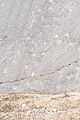
Detailed view of several tracks,
section approx. 24 m × 16 m
Detailed view of individual footsteps,
cutout approx. 4 m × 6 m


swell
- Information page of the Solothurn Nature Museum
- Essay on the dinosaur plate (PDF; 19 kB)
- Courtship Ruchti: Mesozoic: traces in the stone (dionsaur plate)
- Dissertation: Thorsten Michael Scheyer: Comparative bone histology of the turtle shell (carapace and plastron): implications for turtle systematics, functional morphology and turtle origins. Bonn 2007 (PDF; 1.1 MB)
Web links
Individual evidence
- ↑ a b Edith Müller-Merz et al .: Paleontology and Environment. Hochschulverlag der ETH, Zurich 2005, ISBN 3-7281-2972-0 , p. 62 ff. Online on Google Books
- ↑ Susi Iseli: The dinosaur tracks of Lommiswill. ( Memento of the original from August 17, 2007 in the Internet Archive ) Info: The archive link was inserted automatically and has not yet been checked. Please check the original and archive link according to the instructions and then remove this notice. (PDF; 19 kB) In: Lommiswil - Our community.
- ^ Müller-Merz: Paleontology and Environment. P. 66.
Coordinates: 47 ° 14 '12 " N , 7 ° 28' 35.4" E ; CH1903: 602867 / 231752