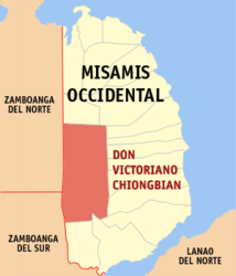
Don Victoriano Chiongbian
| Municipality of Don Victoriano Chiongbian (Don Mariano Marcos) | ||
| Location of Don Victoriano Chiongbian in the Misamis Occidental province | ||
|---|---|---|

|
||
| Basic data | ||
| Region : | Northern Mindanao | |
| Province : | Misamis Occidental | |
| Barangays : | 11 | |
| District: | 2. District of Misamis Occidental | |
| PSGC : | 104217000 | |
| Income class : | 4. Income bracket | |
| Households : | 1815 May 1, 2000 census
|
|
| Population : | 10.183 August 1, 2015 census
|
|
| Coordinates : | 8 ° 15 ′ N , 123 ° 36 ′ E | |
| Mayor : | Annabelle B. Hamoy | |
| Geographical location in the Philippines | ||
|
|
||
Don Victoriano Chiongbian (Don Mariano Marcos) is a municipality in the Philippines in the province of Misamis Occidental . It has 10,183 inhabitants (August 1, 2015 census). Mount Malindang National Park is located in the municipality's area .
Barangays
Don Victoriano Chiongbian is politically divided into eleven barangays .
- Bagong Clarin
- Gandawan
- Lake Duminagat
- Lalud
- Lampasan
- Liboron
- Maramara
- Napangan
- Nueva Vista (Masawan)
- Petianan
- Tuno
