
Dún Ibhir
| Dún Ibhir Dún Ibhir |
|||
|---|---|---|---|
|
|||
| Coordinates | 54 ° 0 ′ N , 9 ° 57 ′ W | ||
| Basic data | |||
| Country | Ireland | ||
| Connacht | |||
| county | Mayo | ||
| ISO 3166-2 | IE-MO | ||
| height | 1 m | ||
| Website | www.dooniver.com | ||

Dún Ibhir ("Ibhirs fortress"; Anglicised Dooniver ) is a settlement on the island of Acaill in the west of the County of Mayo in the province of Connacht . There are several beaches near the town, such as Trá Dhún Ibhir and Bullsmouth Beach. In front of Bullsmouth Beach is the island of Inis Bigil .
location
Dooniver is on the east side of Acaill. The surrounding places are An Ascaill, Tóin an tSeanbhaile, Bun an Churraigh . Dún Ibhir is divided into a number of sub-locations: Béal an Bhulláin (Bullsmouth), Claddagh, Dún Ibhir, The Brae, Baile na Locha (Lakeside), Dionn, Áird Mhór.
education
There is a national school in Dún Ibhir . This was founded in 1910 and was originally located in Bullsmouth, but later moved.
traffic
Bus Éireann goes to the place once a day with the 440 line.
economy
There are a number of commercial and commercial businesses in the area, including a bed and breakfast and a campsite.
literature
- Táin Bó Flidhais - document from the 12th century
- Glenmason Manuscript - 12th century document
- " Fintan mac Bóchra and the falcon from Achilles" - poem from the 15th century
photos

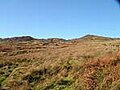
Look to Inis Bigil
Dún Ibhir

Street sign in Dún Ibhir


