Dragoon Mountains
| Dragoon Mountains | ||
|---|---|---|
|
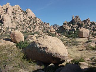
Council Rocks in the Dragoon Mountains |
||
| Highest peak | Mount Glenn ( 2290 m ) | |
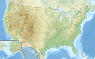
| location | southeastern Arizona, USA | |
|
|
||
| Coordinates | 31 ° 53 ′ N , 109 ° 59 ′ W | |
| surface | 2,390 km² | |
The Dragoon Mountains form a mountain range in Cochise County in southeastern Arizona , USA . The mountain range is around 69 km long and runs in a south-southeast direction. The name means dragoon , which was used to designate a cavalryman with a special rifle. In the US Army of the 19th century, these soldiers were used to fight the Apaches who lived here .
geography
The Cochise County's mountain range begins south of US Interstate 10 , Exit 318, with the Little Dragoon Mountains near the village of Dragoon . Beyond the Texas Canyon , named after a settler from Texas , the actual Dragoon Mountains follow, first running south and finally southeast over a total of 69 km in length, with a maximum width of 56 km and a total area of 2390 km². They end northeast of the town of Tombstone . The highest point is Mount Glenn with 2290 m . The entire region is part of the Coronado National Forest and is a popular hiking and camping area.
The mountain range is one of the so-called Sky Islands in Arizona, which rise suddenly from the surrounding plain , which is predominantly overgrown with sagebrush . It is characterized by rugged, granite rocks, deep crevices and abysses.
history
The Dragoon Mountains became known through the Apache leader Cochise . He had chosen a hidden hideaway in the rocky and impassable mountains, from which the area to the east up to the strategically important Apache Pass could be seen by scouts. Bizarre rock formations blocked the only access to a 10 km long canyon of 16 hectares, in which there was water and grass. Here Cochise and his around 250 Chiricahua warriors and families found a safe refuge after their raids.
US cavalrymen under General George Crook combed the Dragoon Mountains in search of Cochise in 1871, but they were able to repel its warriors with guerrilla tactics and repeatedly escape them in the rough terrain. In 1872 General Oliver Otis Howard was brought into hiding through the mediation of Tom Jefford , a white friend of Cochise, and with the consent of the Indians for peace talks. He managed to make peace with the Chiricahua Apache. Cochise died in June 1874 and was buried in an undisclosed location in a crevice in the middle of the Dragoon Mountains. In 1881 the southeasternmost area of Arizona, Cochise County , was named after him. It is one of the few United States' over 3,000 counties to be named after a single Indian.
The rock hiding place of Chiricahua is now called Cochise Stronghold (Cochise Fortress) and is located on the east side of the Dragoon Mountains at an altitude of around 1525 m west of the village of Sunsites.
Web links
- Cochise Stronghold , accessed June 30, 2014
Individual evidence
- ^ Road Map of Arizona , North Star Mapping, Flagstaff AZ, 1998.
- ↑ a b Alvin M. Josephy jr .: The world of the Indians. Frederking & Thaler GmbH, Munich 1994. ISBN 3-89405-331-3 , pp. 329-331
- ^ Cochise Stronghold , accessed June 30, 2014

