
Dreiborn plateau

The Dreiborn plateau is a large forest and open land area in the Rureifel and part of the Eifel National Park . Large parts of the area were not allowed to be entered by civilians between September 1946 and 2006 and have only been accessible to hikers again on fixed routes since then.
Location and geography


The Dreiborn plateau is roughly bounded by the river valleys of the Erkensruhr , Rur, Urft and Olef. In the south-west it ends roughly behind Schöneseiffen. North of the plateau is the adjacent ridge of the Kermeter .
The plateau is cut through by the B 266 along the Sauerbach, where the Heilsteinquelle presumably already used by the Romans is located (it was rediscovered in 1863); in this respect, the site is divided into an eastern and a western half. The B 258 running in an east-west direction divides the Dreiborn plateau into a northern and a southern part. The place Dreiborn is centrally located in the middle of the plateau. The so-called Drei-Täler-Blick (an elevation at 517 m) as well as Kellenberg and the Wollseifen desert can be accessed by paths in the northern half; Klusenberg, Gierberg and Müsauelsberg are in the southern section. The height of 622.7 m above sea level is reached in the south-western tip of the plateau on Hollerscheid, near a water tank on the B258, north-west. from Kalberberg.
Nature, flora and fauna


Dense beech, oak and spruce forest surrounds the streams and reservoirs at a height of approx. 350 m, which limit the Dreiborn plateau. This forest, which has not been cultivated in the almost 60 years in which the area was a military training area and has in large parts reached a state similar to primeval forest due to old and dead wood that has not been cleared, extends steeply on the valley slopes up to the high plateau, that exceeds 500 m. The national park administration has set itself the goal of preserving this natural forest as a habitat for some rare animal species such as the European wildcat and the establishment of specially protected resting areas around breeding colonies for cormorants , gray herons and black storks .
On the open land areas on the plateau, which were used for agriculture and sheep breeding before the military training area was set up in 1946 and were therefore a cultural landscape, the wide grassy areas are now dominated by the gorse (Eifel gold), which is a tourist attraction during the heyday in May. The national park administration is still developing a concept as to whether and to what extent these open land areas can and should be preserved as former cultural landscapes in order to preserve the panoramas and to make day-active red deer tangible for visitors at specially designated places (e.g. viewing platforms).
If the areas were left to their own devices, bush encroachment and reforestation would normally be expected over time. The red deer would create some clearings, but the wild animals would not be enough to keep larger areas permanently open. Ideas to settle in addition to red deer, roe deer and wild boar , species that occur naturally in the Eifel, also bison , elk and fallow deer to support the concept of keeping open, were discarded because the too harsh winter climate at the heights could cause these animals to migrate to the Would result in valleys, where too close to the localities they could pose a safety risk to people. With a fence one could keep the animals at the height; This would then become a game reserve, which contradicts the national park idea; because 75% of the national park has to represent an unaffected natural landscape, only 25% of the area may be managed by humans in a regulating manner towards a specific goal.
According to the findings at the beginning of the 21st century, the conflicting considerations seem to mean that most of the Dreiborn plateau will be forested again in future generations.
Since July 2019, the Eifel around Monschau has been the third region in North Rhine-Westphalia in which a wolf has settled. The wolf area "Eifel / Hohes Venn", designated by the NRW Ministry of the Environment, around the central Dreiborn plateau, is 505 square kilometers and is located in the Monschau, Hellenthal, Schleiden, Simmerath and Roetgen area.


tourism

The network of hiking trails on the Dreiborn plateau was expanded and marked to a length of approx. 50 km in 2007. Outside the established routes, the landscape may not be entered. Large parts of the Dreiborn plateau cannot be opened to the public without restrictions, as a large part of the former Vogelsang military training area is likely to be contaminated with ammunition residues / old ammunition and an area-wide and deep clearance would be too costly. The problem is the contaminated sites, which not only stem from the post-war use as a firing range and general camp operations, but also to a large extent to ammunition remains from shelling from the Second World War (duds). Presumably, there are still non-clearable areas with so-called glass mines near the dam of the Urft Dam.

Hiking trails run:
- from Erkensruhr and deer scrap to Gierberg, Müsauelsberg, along the source streams of the Erkensruhr and to Dreiborn,
- along Sauerbach and Helingsbach between Einruhr and Dreiborn, Einruhr, Vogelsang and Wollseifen, as well
- between Obersee and Urftsee, Wollseifen and Vogelsang.
Many routes can be combined with one another to form circular hikes and some of them can also be traveled by bike. The Eifel National Park Wilderness Trail leads over the Dreiborn plateau and the fourth stage of the Eifelsteig . There are refreshment stops at the edge of the plateau z. B. in Einruhr, Dreiborn and Herhahn. Various AVV and VRS bus routes connect the villages. Ideally the line 63, which u. a. Einruhr and Vogelsang connect. So are z. For example, long-distance hikes are also possible from the Walberhof car park, with the return journey being made by bus. Guided ranger tours are organized by the national park administration, but many hikers are on their own.
In 2016, the Naturpark-Nordeifel eV set up a total of 4 trekking sites on the plateau or in the Eifel . These places can only be reached on foot. There can / may max. 2 tents can be pitched for a fee.

Warning notices from Herhahn

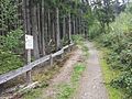
Bollard post with warning of ammunition remains from the former military training area


literature
- NRW Foundation / Eifelverein: Eifel National Park, themed tours, 7 tours for hikers and cyclists , 2nd updated edition 2004, ISBN 3761617410
- Förderverein National Park Eifel (Ed.), Heiko Schumacher (Red.): Flora and fauna in the Eifel National Park: a companion through forest, water and wilderness. Bachem-Verlag, Cologne 2006, ISBN 3-7616-2005-5
Web links
- www.nationalpark-eifel.de (Dreiborner Hochflaeche leaflet) (PDF file; 320 kB)
- www.dreiborner-hochflaeche.de
Individual evidence
- ^ Ewald Gläßer: The natural space units on sheet 122/123 Cologne Aachen . In: Bundesforschungsanstalt für Landeskunde und Raumordnung (Ed.): Geographische Landesaufnahme 1: 200000 Natural Spatial Structure Germany . Self-published, Bad Godesberg 1978 ( online, PDF [accessed on February 16, 2016] Map of the geographical survey of the country, natural structure, see here part 282 -Rureifel-, in particular the sub-area 282.5).
- ↑ http://geographie.giersbeck.de/karten/123.pdf natural spatial structure of the Eifel
- ^ [1] Third wolf area for NRW
- ↑ [2] Wolf area and buffer zone
- ↑ http://www.naturpark-eifel.de/de/der-naturpark/aktuelles/aktuelle-meldung/Saisoneroeffnung-Eifel-Trekking-116m/ Trekking places for hikers in the Eifel
- ↑ http://www.trekking-eifel.de/de/ Trekking tent sites in the Eifel
![[2]](https://ostbelgiendirekt.be/wp-content/uploads/2019/07/610DC6AB-F237-4329-A6A3-089ECA4078A6.jpeg)
Coordinates: 50 ° 33 ′ 48 ″ N , 6 ° 24 ′ 59 ″ E