
Dreiborn (Schleiden)
|
Thriorn
City of Schleiden
|
||
|---|---|---|
 |
||
| Height : | 563 (535-590) m above sea level NHN | |
| Area : | 7.5 km² | |
| Residents : | 989 (Oct 31, 2015) | |
| Population density : | 132 inhabitants / km² | |
| Incorporation : | January 1, 1972 | |
| Postal code : | 53937 | |
| Area code : | 02485 | |
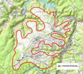
Location of Dreiborn in North Rhine-Westphalia |
||
 View over the Dreiborn plateau
|
||

,_Burg_Dreiborn_005.jpg)


The Eifelort Dreiborn , located in the district of the same name , is a district in the west of Schleiden in the North Rhine-Westphalian district of Euskirchen .
Geographical location
Dreiborn is centrally located in the Rureifel on the Dreiborn plateau at 563 m above sea level.
history
In 1334 the castle "Troys Fontainez" (= three sources, so three born) was first mentioned. Count Wilhelm V von Jülich took it as a fief from King John of Bohemia from the House of Luxembourg. The Jülich people seem to have inherited the Dreiborn rule from the noblemen of Hengebach (= Heimbach).
In addition to the castle, large parts of the villages of Dreiborn and Morsbach as well as Malsbenden, Gemünd and Mauel (each to the left of the Urft) and Berescheid, Ettelscheid, Scheuren, Dieffenbach, Nierfeld, Herhahn and the parish of Olef belonged to the rule.
"Unterherrschaft" were a peculiarity of the Duchy of Jülich. Unlike the Jülich offices, they were relatively independent. After various noble families (under Rabolt von Plettenberg, founding of an ironworks in Olef in 1531), the von Harff family took over rule in Dreiborn in 1585, which it held until 1794. The von Harff family had their burial place in the Olefer parish church of St John the Baptist, who achieved considerable prosperity, as Roidkins' splendid castle pictures show, and who were raised to the baron status in 1650.
From 1794 to 1815 the French occupied the entire left bank of the Rhine. At that time Dreiborn belonged to the French department of Rur. Then it became Prussian. From 1816 to 1971 the place was an independent municipality in the Schleiden district, which was dissolved in 1972 . On January 1, 1972, the majority of the community Dreiborn was incorporated into the town of Schleiden. The last mayor of the municipality of Dreiborn was Hubert Heinen. The districts of Einruhr and Hirschrott were reclassified to Simmerath in the Aachen city region .
Location structure
The place has the church of St. George , a kindergarten, a primary school with a gym, a fire station , a sports field with a multi-purpose building, a café, a restaurant and a youth home. On the eastern edge of the village is Dreiborn Castle - also called Dreiborn Water Castle .
dialect
Eifeler Platt is spoken in Dreiborn . It contains some words that can be found specifically in Dreiborn (e.g. bääht = ready, broken, exhausted; jarz / jachz = bitter; Quespel = hand brush; verlaade = very busy; luertz = left; Pööp = headscarf; bestaade = to marry). Dreiborn itself is called "Drommer" in the Dreiborn plateau .
traffic
The next federal highways are the B 266 and the B 258 . The next motorway connections are the A 1 in Nettersheim and Euskirchen Wißkirchen and the Aachen Lichtenbusch junction to the A 4 .
Since the Dreiborn plateau was used as a military training area, a concrete slab tank road runs west of Dreiborn in a narrow forest . After the military training area was closed, there were plans to use the route as a bypass. Out of consideration for the national park and because of the low demand, this planning was stopped in 2011.
Local public transport 
The local public transport provided as part of the basic service is as follows:
- the bus line 831 to Gemuend and Schleiden, wherein a majority of journeys as TaxiBus be carried out (only at tel. reservation), whereby the fare compared to the bus increases by 50%.
- a trip in school traffic on line 836 (Hellenthal -) Schöneseiffen - Harperscheid - Schleiden to Schleiden
- One trip in each direction on Sundays and public holidays on line 815 (bicycle bus) Gemünd - Kall - Monschau .
Nature and recreation
Interesting for tourists is the altitude with a far-reaching view, the Eifel National Park , the Dreiborn plateau . The proximity to the Olef and Urft reservoirs, the large number of marked hiking and cycling trails, the connection to the public transport network of the AVV and VRS. Something special is the gorse blossom in May to June on the Dreiborn plateau in the Eifel National Park. The golden yellow natural spectacle can be admired over large parts of the open plateau.
Dreiborn plateau

Panorama with a distant view of Kesternich

View of Vogelsang Castle with "Eifelgold" (gorse blossom)

The extensive Dreiborn plateau in May

Übermannshohe Ginstergasse


Personalities
- Clemens August von der Wenge (1740–1818), hereditary bailiff, inheritance judge, general of the Münster troops
- Bernhard Josef Hilgers (1803–1874), theologian
- Michael Ulrich Dardenne (1924–2001), ophthalmologist
- Bruno Ix (1936–2017), theologian and pastor
- Sonja Steffen (* 1963), politician
- Noah Katterbach (* 2001), soccer player
literature
- Daniel Jäger, Sven Kirch, Alfred Wolter: Dreiborn - The village of the Eifel. 2011.
Web links
- Dreiborn town portrait on www.schleiden.de
- Dreiborn introduces itself (Dorfgemeinschaft Dreiborn eV)
- Dreiborn in February 1945
- Bernhard Joseph Hilgers
Individual evidence
- ^ Federal Statistical Office (ed.): Historical municipality directory for the Federal Republic of Germany. Name, border and key number changes in municipalities, counties and administrative districts from May 27, 1970 to December 31, 1982 . W. Kohlhammer, Stuttgart / Mainz 1983, ISBN 3-17-003263-1 , p. 309 .
- ↑ Dreiborn bypass stopped . Friends of the Eifel National Park. Retrieved April 26, 2013.
- ↑ The municipalities of Bad Münstereifel, Blankenheim, Dahlem, Hellenthal, Kall, Schleiden and Weilerswist are taking part in a pilot project. The surcharge for using the TaxiBusPlus is 1.20 euros for adults and 0.50 euros for children. For this, the journey in these municipalities can end not only at the public transport stops, but also at another point on the route in the vicinity of the destination stop (e.g. front door). Timetable 831 as pdf
- ↑ [1] Taxibusplus

Berescheid | Broich | Bronsfeld | Thorn | Ettelscheid | Gemünd | Harperscheid | Herhahn | Kerperscheid | Morsbach | Nierfeld | Oberhausen | Olef | Scheuren | Schleiden | Schöneseiffen | Wintzen | Wolf garden