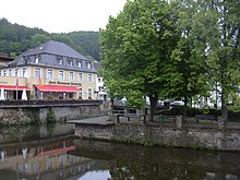
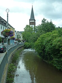
Gemünd (Schleiden)
|
Gemünd
City of Schleiden
|
||
|---|---|---|
| Coordinates: 50 ° 34 ′ 19 ″ N , 6 ° 30 ′ 0 ″ E | ||
| Height : | 339 m | |
| Area : | 21.94 km² | |
| Residents : | 4260 (Oct 31, 2015) | |
| Population density : | 194 inhabitants / km² | |
| Incorporation : | January 1, 1972 | |
| Postal code : | 53937 | |
| Area code : | 02444 | |
|
Location of Gemünd in North Rhine-Westphalia |
||
|
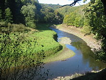
Gemünd in the Urft Valley in autumn 2013
|
||
With over 4250 inhabitants, Gemünd is the most populous district of Schleiden in the Eifel and a recognized Kneipp spa.
geography
In Gemünd the Olef flows into the Urft ; this explains the name etymology of the place.
Located on the southern slope of the Kermeter high forest and east of the Dreiborn plateau , Gemünd forms the southeastern gateway to the Eifel National Park ; the other two gates to this core zone of the German-Belgian nature park are Rurberg in the west and Heimbach in the northeast.
history
"Gemunde" is mentioned in a document for the first time in 1213; At that time, Hermann von Jünkerath bequeathed a forest to Steinfeld Monastery along the historic Roman road to a bridge at the confluence of the Urft and Olef; this document is in the Cologne city archive.
Incidentally, the place had a divergent history until the Left Bank of the Rhine was taken over by French revolutionary troops : Becausethe left Urftseite belonged in the Middle Ages to the County of Harff zu Dreiborn and the right to the Office Heimbach within the Duchy of Jülich ; Both territories fell to Prussia at the Congress of Vienna in 1815 .
This division was also carried out ecclesiastically in the Old Kingdom , which was particularly important since the Reformation: on the left of the Urft the exclusively Catholic Dreiborn parish of Olef was responsible and on the right of the Urft the parish of Heimbach ( belonging to the Mariawald Abbey since 1521 ), which also tolerated Protestants . This explains why Gemünd had a reformed parish early on (1609) within the largely Catholic North Eifel .
In the course of the Prussian reorganization of the Rhineland after the Congress of Vienna, Gemünd became the head of a district of Gemünd in the newly formed administrative district of Aachen in 1816 . District was Clemens August von Syberg (1754-1833). The offices were located in the house of Mayor Huttanus in the Bäckergäßchen. After the district administrator retired in 1829, the administration was moved to the ducal-Arenberg castle in Schleiden and the Gemünd district was renamed Schleiden district .
In the 19th century, Gemünd, which had known iron smelting since the 15th century, developed into an industrial location under the brothers Reinhard Poensgen and Albert Poensgen . Over 500 workers were employed in two rolling mills for gas and boiler pipes and a wire factory. The charcoal required for the smelting process was supplied by over 1000 charcoal burners from the deciduous forests of the Kermeter. But when charcoal became scarce due to excessive exploitation in the middle of the 19th century, a rail connection could not be established in time to procure the coal elsewhere and the coal from the Ruhr area was already superior to charcoal as an energy supplier, the iron industry in the Schleiden area could not do itself hold more. Poensgens moved production to Düsseldorf in 1860; the population of Gemünd decimated, a city fire in 1851 also contributed to the decline.
The beginnings of tourism in Gemünd go back to the turn of the 20th century. Less than 20 years after the Eifelverein was founded in 1888, the Urfttalsperre was completed (1905) and developed into a local recreation area even before the First World War .
The Second World War in 1944/45 brought a serious slump in the economy with extensive destruction of the historical building fabric; the establishment of the Vogelsang military training area in September 1946 included previously attractive hiking destinations in the Urft valley west of Malsbenden, on the Urftsee and on the Dreiborn plateau near Wollseifen in the restricted military area. Nevertheless, Gemünd continued to strive for tourism by concentrating on the remaining network of trails and set up a spa in the 1970s. Gemünd was recognized as a Kneipp spa in 1978.
The region has belonged to the state of North Rhine-Westphalia since 1946 . The regional reform (§ 9 Aachen Law ), which came into force on January 1, 1972, merged the town of Gemünd with the town of Schleiden. Since then it has been part of the city of Schleiden.
At the beginning of the 21st century, new tourist perspectives are opening up for Gemünd as a national park, and especially since the military training area was closed on January 1, 2006, thanks to a new network of hiking trails in the areas that were previously inaccessible to civilians for 60 years.
Worth seeing
Gemünd lies at the intersection of federal highways 266 ( Kölner Straße / Aachener Straße from Simmerath to Linz am Rhein) and 265 ( Luxemburger Straße / Dürener Straße from Cologne to Prüm) at the confluence of the Olef and Urft. The baroque statue of the bridge saint John of Nepomuk , made around 1730, made of red sandstone based on the model of the Prague bridge figures , on a pedestal from 1738 with the Harff / Hoheneck coat of arms, has marked this point since 1859/60; previously it or an older forerunner stood on the Urft Valley Bridge, which was renewed in 1734. The original figure is now in the Kurhaus; there is a cast at the current location.
The spa center connects to the north of the town center above the confluence.
Town center
In terms of architecture, today's Gemünd is largely shaped by the 20th century due to the war; only a little older building fabric has been preserved.
The Catholic parish church of St. Nikolaus in brick was built in 1857–1862 according to plans by the Aachen builder Theodor August Stein as a three-aisled stepped hall with a tower that was only completed in 1888/89 and linked to late Gothic hall churches of this type; an older building (presumably from the 13th century) had to give way.
The Protestant church, built in simple baroque forms, dates from 1753, in 1851/52 a tower in the style of a round arch was added to it according to plans by the Aachen agricultural inspector Johann Peter Cremer ; At the Protestant cemetery on the Tricht , tombstones from the 17th and 18th centuries have been preserved.
There are only a few listed houses from the turn of the 19th to the 20th century, for example
- a building at Bahnhofsstrasse 1 (1857), today a Protestant youth home in Schleiden-Gemünd .
- a building in Bahnhofstrasse 2 with a corner project, three half-timbered gables and a hipped roof (1896),
- two brick villas in neo-renaissance style, Bergstrasse 15 (1885) and 17 (1901),
- in the Kölner Straße 57-59 (in the former Mauel district) a plastered group of buildings in classical forms with a three-story tower, recessed intermediate wings and a two-story residential building under a crooked hip roof . In research it is controversial whether the building was rebuilt in 1847 or whether an older house was completely rebuilt in typical forms.
The infrastructural center is the Dreiborner Straße (pedestrian zone) with retail shops, cafés and restaurants as well as the renovated old school, which also hosts art exhibitions.
Spa center
The spa facility in Gemünd offers various physiotherapeutic applications (e.g. massages, migraine treatments, medicinal baths, fango packs, Kneipp treatments). The associated spa hotel - a forerunner inn goes back to the 19th century - is not only aimed at spa guests, but also at participants in conferences, seminars and workshops.
The spa park district includes a music pavilion for spa concerts, a small guest theater, a library, an outdoor pool with extensive rose plants (so-called rose bath ) and facilities for other leisure activities (mini golf, tennis, bowling, horse riding).
The national park administration has set up a permanent exhibition in the guest house on the subject of "Gnarled oaks, colorful woodpeckers and forest history (s)". The middle woodpecker , as portrayed by the local animal painter Conrad Franz, is the emblematic animal for the Gemünd National Park, which was opened on October 20, 2005 by the North Rhine-Westphalian Environment Minister Eckhard Uhlenberg .
An acting showcase with a life-like reconstructed forest of oaks, underbrush, foliage and typical animals of the national park ( deer , pine marten , green woodpecker , great tit , sparrow hawks , woodcock , jay , nuthatch , middle spotted woodpecker and smooth snake ) is the core of the permanent exhibition. The ecological balance of the forest habitat is explained using various animation programs.
In a second exhibition room the historical use of the forest from the medieval charcoal burning to the Prussian reforestation program 1815–1939 with spruce (Prusseboom) to the revitalization of the natural beech stock at the Kermeter aimed at by the national park administration at the beginning of the 21st century is documented. Alongside historical photos, a video explains the charcoal burner's work in a coal pile. An animation program with proverbs and idioms like Gleich und Gleich like to join in - said the devil to the charcoal burner accompanies the explanations.
Tourism and transport
In addition to the spa hotel, there are a number of other hotels, cafes and restaurants that are geared towards spa guests. There is a holiday park apartment complex on a hillside (Salzberg).
Gemünd has a stop with a reception building and tunnel on the Oleftalbahn, which is currently used for tourism . This is also where wood loading work and wood transport in the direction of Kall take place. The public transport is now exclusively with buses performed. Gemünd is an important junction, from Gemünd there are u. a. Lines to Hellenthal / Schleiden, Kall, Heimbach, Vogelsang / Aachen and Dreiborn / Monschau. The traffic is carried out either by Regionalverkehr Köln or BVR Busverkehr Rheinland .
After the training area was cleared by the Belgian military administration on January 1, 2006, the national park administration opened a number of new hiking and cycling trails along the Urft to the Urfttalsperre, on the Dreiborn plateau and to the former NS-Ordensburg Vogelsang , now a memorial site and museum, to Wollseifen and Einruhr marked. The dam can be committed. There is a restaurant on the dam, but it cannot be reached by car. However, it is possible to reach the dam by bus from Gemünd or the Kermeter parking lot. These areas are particularly valued for nature lovers because nature, flora and fauna in the forests and open land areas could develop largely undisturbed in 60 years of isolation from humans (1946 - end of 2005).
Bike paths
The Eifel-Höhen-Route cycle path leads through the village, a circular route around and through the Eifel National Park .
The valley route cycling route also leads through the village. It opens up interesting tourist spots in North Rhine-Westphalia on a family-friendly route.
Network of hiking trails
The traditional hiking trails of the Eifelverein run over Wolfgarten and the Kermeter to the Mariawald and Heimbach Abbey on the one hand and over the Kermeter heights above the Verbrannter Berg district to Paulushofdamm to the Rurtalsperre on the other. The Oleftalweg along the Olef to Schleiden and Hellenthal and through the Olefer Kirchenwald to Kall are marked as further routes . These route tours, too far to be individually combined into circular hikes, are usually undertaken in an organized manner. In addition, Gemünd is one of the central starting points of the Eifelsteig long-distance hiking trail , which leads in 15 sections and over a total length of 313 kilometers from the Aachen district of Kornelimünster to Trier and was officially opened on April 4, 2009; Gemünd is the destination of the fourth stage, which stretches from Einruhr along the Obersee and the Urfttalsperre as well as Wollseifen and Vogelsang (around 22 kilometers), and at the same time the starting point of the fifth stage, which goes over a length of around 18 kilometers to Steinfeld Monastery .
Local public transport
Gemünd is in the network area of the Rhein-Sieg transport association (VRS) . The VRS bus routes are operated by Regionalverkehr Köln (RVK). In addition, Gemünd is also served by a bus line from the Aachen Transport Association (AVV).
| line | course |
|---|---|
815 |
Forest line: Kall Bf - Gemünd - Monschau |
829 |
Kall Bf - Gemünd - Schleiden - Hellenthal |
831 |
Gemünd - Herhahn - Morsbach - Dreiborn - Schleiden |
895 |
Wolfgarten - Gemünd - Malsbenden - Salzberg |
SB82 |
National Park Shuttle : Kall - Vogelsang |
| line | course
|
|---|---|
| 231 | Düren Bf / ZOB - StadtCenter - Kaiserplatz - Josefskirche - Stockheim - Froitzheim - Ginnick - Embken - ( Muldenau ←) Wollersheim - Vlatten - Hergarten - Heimbach Bf - ( Hasenfeld - Schwammenauel - Kermeter - Urfttalsperre / Hastenbach - / Mariawald Abbey -) Wolfgarten - Gemünd - Nierfeld - Olef - Schleiden |
In addition, trains of the Oleftalbahn stop irregularly in Gemünd .
Public facilities
Gemünd has three kindergartens and one elementary school. The next high school is in Schleiden. There is also a district court and a tax office in Gemünd.
Personalities
- Wilhelm Matthießen (1891–1965), writer
- Udo Bielenberg (* 1938), civil engineer and Low German author
literature
- Ruth Schmitz-Ehmke , Barbara Fischer: The architectural and art monuments of the Euskirchen district. City of Schleiden. Berlin 1996.
- Wilhelm Günther: Gemünder town history in the mirror of old pictures (= home calendar of the Schleiden district. ) Schleiden 1968.
- Wilhelm Günther: When Gemünd was still the main town of the district (= home calendar of the Schleiden district. ) Schleiden 1965.
- Peter Neu: Iron industry in the Eifel. Cologne 1988.
- Ulrike Schwieren-Höger: Nature and culture guide for the Eifel National Park and its nine cities and communities. Gaasterland-Verlag, Düsseldorf 2007, ISBN 978-3-935873-22-2 .
- Ernst Wackenroder : The art monuments of the Schleiden district . Düsseldorf 1932.
- Hanna Wachtel, Lothar Braunisch: Schleiden-Gemünd. Stadt-Bild-Verlag, Leipzig undated
Individual evidence
- ↑ Population statistics of the city of Schleiden ( Memento from March 4, 2016 in the Internet Archive ) (PDF; 20 kB)
- ^ District President Aachen (Ed.): 150 years of government and administrative district Aachen. Contributions to their history. Aachen 1967
- ^ Federal Statistical Office (ed.): Historical municipality directory for the Federal Republic of Germany. Name, border and key number changes in municipalities, counties and administrative districts from May 27, 1970 to December 31, 1982 . W. Kohlhammer, Stuttgart / Mainz 1983, ISBN 3-17-003263-1 , p. 309 .
- ^ Georg Dehio: Handbook of German Art Monuments, Rhineland. Deutscher Kunstverlag, 2005, p. 435.
- ^ A b Georg Dehio: Handbook of German Art Monuments, Rhineland. Deutscher Kunstverlag, 2005, p. 434.
- ↑ Gastronomy Urftsee dam wall
Web links
- Ernst Ludwig Haeger: “Visiting card” of the formerly flourishing iron industry in Gemünd. In: Economic, social and traffic events in the Rhineland. Heinrich Klein, 2003 (private website, source: Euskirchen district - 1982 yearbook).
- Schleiden-Gemünd war cemetery


