
Call
| coat of arms | Germany map | |
|---|---|---|

|
Coordinates: 50 ° 32 ' N , 6 ° 33' E |
|
| Basic data | ||
| State : | North Rhine-Westphalia | |
| Administrative region : | Cologne | |
| Circle : | Euskirchen | |
| Height : | 389 m above sea level NHN | |
| Area : | 66.07 km 2 | |
| Residents: | 11,191 (Dec. 31, 2019) | |
| Population density : | 169 inhabitants per km 2 | |
| Postal code : | 53925 | |
| Primaries : | 02441, 02445, 02447, 02482, 02486 | |
| License plate : | EU, SLE | |
| Community key : | 05 3 66 024 | |
| LOCODE : | DE KAL | |
| Community structure: | 23 districts | |
| Address of the municipal administration: |
Bahnhofstrasse 9 53925 Kall |
|
| Website : | ||
| Mayor : | Hermann-Josef Esser ( CDU ) | |
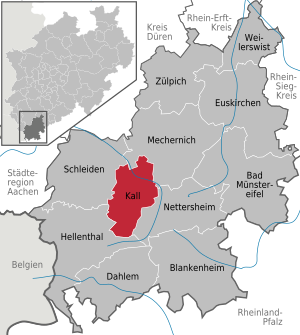
| Location of the municipality of Kall in the Euskirchen district | ||
  |
||


Kall is a municipality in the district of Euskirchen in North Rhine-Westphalia in the northern Eifel .
geography
Geographical location
Kall lies on the edge of the North Eifel in the triangle between Cologne, Aachen and Trier at an altitude of 399– 538 m above sea level. NHN . In Kall the Kallbach flows into the Urft . The village of Kall is surrounded by large forest areas. A special feature is the red sandstone massif that emerges through outcrops and is called rock by the Kallern . This is how new building areas have been named afterwards ( Zum Felsblick or Auf dem Fels ).
Community structure
Kall consists of the following 23 districts (population as of June 30, 2016 in brackets):
- Anstois (95)
- Benenberg (111)
- Diefenbach (77)
- Dottel (172)
- Frohnrath (136)
- Gillenberg (55)
- Golbach (597)
- Kall (5,340)
- Keldenich (853)
- Krekel (233)
- Gutters (341)
- Lifter (61)
- Rueth (47)
- Scheven (527)
- Sistig (769)
- Soetenich (997)
- Steinfeld (165)
- Steinfelderheistert (127)
- Rhinestone bushes (17)
- Urft (321)
- Elections (451)
- Wallenthal (191)
- Wallenthalerhöhe (23)
Neighboring communities
- The municipality of Kall borders on the municipalities of Hellenthal and Nettersheim and the towns of Schleiden and Mechernich.
- Kall is the only municipality in the Euskirchen district that has no border with any other district.
climate
Since Kall is on the edge of the Eifel, the climate is characterized by the harsh Eifel climate. The bioclimatic conditions are favorable in the Eifel. Heat stress and humid air rarely occur in summer. Overall, Kall has a decidedly stimulating climate. Kall is a clean air area with very little air-chemical pollution. On hot sunny days, there is sometimes an increased concentration of ground-level ozone.
history
Incorporations
On July 1, 1969, the previously independent communities Golbach, Keldenich, Sistig, Sötenich, Urft, Wahlen and Wallenthal were incorporated.
Outsourcing
On January 1, 1972, localities that previously belonged to the municipality of Wahlen, with an area of 18.18 km² and 925 inhabitants, were reclassified from Kall to Hellenthal. Further parts of the area were ceded to the community of Mechernich and the city of Schleiden.
religion
Churches and parishes:
- Catholic parish of Kall St. Nikolaus
- Ev. Trinitatis parish Schleidener Tal
- Hubertus Chapel
- St. Antonius (Dottel)
- St. Dionysius (Keldenich)
- St. Barbara (Krekel)
- St. Apollinaris and Agatha (Scheven)
politics
mayor
Hermann-Josef Esser (CDU) has been the mayor of the municipality of Kall since September 24, 2017.
Municipal council
The Kaller municipal council consists of 28 council members and the presiding mayor. The CDU (12 seats) and the Greens (3 seats) have joined a list and thus have a majority of the votes in the council.
The chairman of the CDU parliamentary group is Bert Spilles, Kall. The group of the Greens is led by Ekkehard Fiebrich, Sistig. The SPD is led by Erhard Sohn, Scheven. The parliamentary group leader of the FDP is Manfred Wolter.
Mayor
Acting mayor for the central town of Kall and the towns of Anstois and Wackerberg has been Stefan Kupp, CDU, since January 1, 2018.
badges and flags
coat of arms
The municipality of Kall was granted the right to use a coat of arms and a seal with a certificate from the district president in Cologne dated June 10, 1974.
|
|
Blazon : “Half-split and divided by blue and gold (yellow) over silver (white). In the blue field sprinkled with golden (yellow) lilies, a left-turning, growing, golden (yellow) crowned, red-tongued, silver (white) lion; in the golden (yellow) field a growing, red armored and tongued black lion; in the silver (white) field two fallen, diagonally crossed, black arrows. " |
| Justification of the coat of arms: The coat of arms combines the coats of arms of the former territorial lords of today's municipality: the Lords of Schleiden and the Dukes of Jülich. the crossed arrows are taken from the coat of arms of the Steinfeld Abbey, the cultural and historical center of the municipality. |
flag

The municipality of Kall was granted the right to use a flag as a hoisting flag in a certificate from the district president in Cologne dated June 8, 1990.
Description of the flag: "From white and black in a ratio of 1: 1 longitudinally with the coat of arms of the municipality shifted from the center to the pole, corresponding to the description in paragraph 1 of the main statute ."
partnership
The Belgian municipality of Mol in Flanders and the municipality of Kall have been in partnership since 1980 .
tourism

Kall is located in the North Eifel Nature Park and is the national park location for the Eifel National Park . The area used to be characterized by mining and metal processing , especially iron ores and lead ores . A mining historical hiking trail, the Pingen hiking trail in Kall (12 km), created in cooperation with RWTH Aachen University, tracks this down. Kall is also on the Römerkanal hiking trail from Nettersheim to Cologne along the Eifel aqueduct .
The Steinfeld Monastery is well worth seeing .
Government bunker NRW
In the nearby Gillesbachtal is the nuclear-bomb-proof government bunker of the state government of North Rhine-Westphalia . The underground building has a total of 100 rooms on two floors, in which the Prime Minister of the country could stay with about 100 employees for up to 30 days. The facility, which was operated from 1960 to the second half of the 1980s, had the cover name "Warnamt Eifel". Every two years from 1966 to 1989 exercises were held in which the emergency was played out. After the Cold War , the bunker was sold to a family who maintain it as a documentation center and offer tours.
Walking and cycling
The 330 km long Eifelsteig , a hiking trail from Aachen to Trier , runs through the municipality of Kall . Stage 5 leads from Gemünd to Steinfeld Monastery, a very varied mixture of forest, panorama, valley and high-altitude trails. Stage 6 then from Steinfeld Monastery to Blankenheim.
The Eifel-Höhen-Route cycle path , which runs around the Eifel National Park , leads through the village .
The valley route cycling route also leads through the village. It opens up interesting tourist spots in North Rhine-Westphalia on a family-friendly route.
schools
The municipality of Kall is one of the most important school locations in the entire Euskirchen district.
Elementary schools
- Community elementary school Kall, Auelstraße (open all day)
- Sistig Community Primary School (open all day)
secondary schools
- Secondary school Kall, Auelstraße (open all day)
- The secondary school has not formed an entry class (grade 5) since 2013.
Secondary school
- Secondary school Mechernich-Kall, Auelstraße (full day)
- Since the school year 2012/13, secondary school has been offered in Kall, together with the city of Mechernich. All degrees could be obtained here. The secondary school Mechernich-Kall was converted into a comprehensive school for the 2015/16 school year. The secondary school at the Kall location was closed on July 31, 2015.
Further training
- Hermann Josef Kolleg Kall-Steinfeld (grammar school) in Steinfeld Monastery
- Vocational college Eifel (vocational school and business school)
- Technical school for tourism
Special schools
- St. Nikolaus Schule Kall (special school with a special focus on intellectual development)
- School for Educational Aid, Urft
Transport infrastructure
Road traffic / public transport

According to its location, Kall is roughly the intersection between the cities of Aachen and Koblenz or Cologne and Trier; it is accessed directly via the B266 . The federal motorway 1 can be reached in a few minutes via the junction 111 Wißkirchen (Euskirchen), 112 Bad Münstereifel / Mechernich or 113 Nettersheim .
Several regional bus routes in Cologne connect Kall with the surrounding districts, the Schleidener Tal, Zingsheim , Mechernich and Marmagen . Most of the trips (except into the Schleidener Tal) are carried out by taxi bus, after prior telephone appointment.
The 829 bus connects Kall with the town of Schleiden and the municipality of Hellenthal at least every hour, and every 30 minutes during rush hour. (with connection in Kall to the RE22 and RB24 to / from Cologne)
Rail transport

The Kall Station houses a customer who has been a major renovation in 2009 RVK with an information center for the Eifel National Park . It is located on the Eifel route ( Cologne - Euskirchen - Gerolstein - Trier ) and is served by three local rail lines.
In addition to the RE22 lines, the RB24 line compresses the train service to Cologne to an all-day 30-minute cycle. In addition, there are individual sprinter performances of the RE 12. The Oleftalbahn ( museum railway ) begins in Kall via Gemünd and Schleiden to Hellenthal , which is in use in the summer months.
Other stations in the municipality are Scheven ( demand stop , hourly service possible through the RB24) and Urft (hourly service through the RE22). During the summer months, the Oleftalbahn ( museum railway ) runs from Kall train station via Gemünd and Schleiden to Hellenthal .
The regional tariff of the Verkehrsverbund Rhein-Sieg and the NRW tariff apply to all local public transport .
Personalities
Sons and daughters of the church
- Hubert Schlemmer (1862–1945) Eifel painter, born in Kall
- Nikola Reinartz (1874–1954) Catholic priest (most recently pastor in Kreuzweingarten since 1920) and local researcher, born in Heistert
- Albert Larres (1900–1987) Eifel painter, born in Obergolbach
- Werner Schumacher (1932–1990), CDU politician, long-time member of the NRW state parliament and mayor of Kall
- Kajo Schommer (1940–2007), CDU politician, Saxon State Minister
- Günter Limburg (1960), artist, painter and private lecturer, lives and works e.g. Currently in Cologne
Personalities
- Jürgen Schmitt (* 1949 in Bonn ), artist, singer, composer and lyricist, lives in Scheven
- Norbert Scheuer (* 1951 in Prüm), writer, lives in Keldenich
- Theo Breuer (* 1956 in Bürvenich ), writer and editor, lives in Sistig
- Marion Schmitt (* 1959 in Cologne ), writer, lives in Scheven
- Walter Lehnertz (* 1967 in Prüm ), German art and antiques dealer and television personality, lives and works in Krekel
literature
- Norbert M. Borengässer: Family book of the parish of St. Nikolaus, Kall 1710–1900, as well as a contribution to the history of Kall mainly in the 19th century . Bonn 2016, ISBN 978-3-923946-82-2 .
- Hubert Büth: Kall in the mirror of history . A text and picture chronicle. Kall 2014, ISBN 978-3-944976-13-6 .
- Hans Peter Schiffer: The "good old days" in the municipality of Kall . Ed .: Municipality of Kall. Meinerzhagener Druck- u. Publishing house, Meinerzhagen 1983, ISBN 3-88913-066-6 .
- Hans Peter Schiffer: Churches and chapels in the municipality of Kall. Kall 1999.
- Hans Peter Schiffer: Municipality of Kall . History and folklore. Ed .: Municipality of Kall. Kall 2002.
- Andreas Züll: Kall's never built explosives factory in World War I (1914–1918). In: Yearbook of the District of Euskirchen 2018. P. 57–63.
- Andreas Züll: From the barracks cinema to the Rex film theater. On the history of the cinema in Kall 1940 to 1985. In: Jahrbuch des Kreis Euskirchen 2018. S. 20–29.
Web links
- Life and work of the pastor and local researcher Nikolaus Reinartz from Kall-Heistert
- In search of Eisenstein - traces of Kaller miners (Nikolaus Kley and Hans-Georg Brunemann)
Individual evidence
- ↑ Population of the municipalities of North Rhine-Westphalia on December 31, 2019 - update of the population based on the census of May 9, 2011. State Office for Information and Technology North Rhine-Westphalia (IT.NRW), accessed on June 17, 2020 . ( Help on this )
- ^ Municipality of Kall - residents by district , accessed on November 29, 2016
- ↑ Martin Bünermann: The communities of the first reorganization program in North Rhine-Westphalia . Deutscher Gemeindeverlag, Cologne 1970, p. 100 .
- ^ Federal Statistical Office (ed.): Historical municipality directory for the Federal Republic of Germany. Name, border and key number changes in municipalities, counties and administrative districts from May 27, 1970 to December 31, 1982 . W. Kohlhammer, Stuttgart / Mainz 1983, ISBN 3-17-003263-1 , p. 309 .
- ↑ Council election 2014. Overall result of the municipality of Kall. May 25, 2014, accessed July 4, 2014 .
- ↑ Main statute of the municipality of Kall, § 2. (PDF; 55 kB) Retrieved on December 8, 2015 .
- ↑ The Kaller municipality coat of arms. Retrieved January 4, 2013 .
- ↑ Bernd F. Meier: Five to twelve: In the former government bunkers in the Eifel. In: Aachener Zeitung. June 13, 2014, accessed February 3, 2016 .
- ↑ Schools. Municipality of Kall, accessed on November 21, 2015 .
Bad Münstereifel | Blankenheim | Dahlem | Euskirchen | Hellenthal | Kall | Mechernich | Nettersheim | Schleiden | Weilerswist | Zülpich
Anstois | Benenberg | Diefenbach | Dottel | Frohnrath | Gillenberg | Golbach | Kall | Keldenich | Krekel | Gutters | Harvester | Rüth | Scheven | Sistig | Sötenich | Steinfeld | Steinfelderheistert | Rhinestone bushes | Urft | Elections | Wallenthal | Wallenthalerhöhe