Diefenbach (Kall)
|
Diefenbach
Municipality of Kall
Coordinates: 50 ° 29 ′ 22 ″ N , 6 ° 32 ′ 15 ″ E
|
|
|---|---|
| Height : | approx. 520 m above sea level NHN |
| Residents : | 63 (Dec. 31, 2019) |
| Postal code : | 53925 |
| Area code : | 02441 |
|
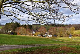
Diefenbach, town view from the south
|
|
Diefenbach is a district of the municipality of Kall in the district of Euskirchen , North Rhine-Westphalia .
geography
The place is between Sistig and Wahlen directly on the Krekeler Heide . District road 78 runs through the village. The Kuttenbach flows through the center of the village .
history
Until the end of the 18th century, Diefenbach belonged partly to the Reifferscheid rule and partly to the Wildenburg rule . Until 1971 the place belonged to the Schleiden district .
Attractions
- Private chapel of the Willems family
Web links
Commons : Diefenbach - Collection of images, videos and audio files
Individual evidence
- ↑ residents by district. Municipality of Kall, accessed on March 4, 2020 .
- ^ Wilhelm Fabricius : Explanations for the Historical Atlas of the Rhine Province. The map of 1789 (2nd volume). Bonn 1898, p. 507.

