Gillesbach (Urft)
|
Gillesbach formerly Jellesbach |
||
|
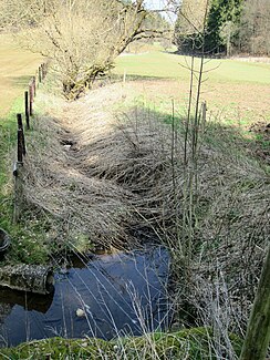
Gillesbach (upper course) |
||
| Data | ||
| Water code | DE : 28224 | |
| location |
Eifel
|
|
| River system | Rhine | |
| Drain over | Urft → Rur → Maas → Hollands Diep → North Sea | |
| River basin district | Meuse | |
| source | in the Eastern Eifel near Rüth 50 ° 27 '56 " N , 6 ° 32" 49 " E |
|
| Source height | approx. 580 m above sea level NHN | |
| muzzle | in Urft in Urft coordinates: 50 ° 30 ′ 43 ″ N , 6 ° 34 ′ 51 ″ E 50 ° 30 ′ 43 ″ N , 6 ° 34 ′ 51 ″ E |
|
| Mouth height | approx. 406 m above sea level NHN | |
| Height difference | approx. 174 m | |
| Bottom slope | approx. 26 ‰ | |
| length | 6.6 km | |
| Catchment area | 15.644 km² | |
| Discharge A Eo : 15.644 km² at the mouth |
MNQ MQ Mq |
46.24 l / s 194.6 l / s 12.4 l / (s km²) |
| Left tributaries | Fischbach | |
| Right tributaries | Marmagener Bach | |
| Communities | Rüth , Marmagen , Wahlen , Urft | |
|
Gillesbach near Marmagen |
||
The Gillesbach (formerly Jellesbach) in the North Rhine-Westphalian district of Euskirchen is an approximately 6.6 km long, southern and left tributary of the Urft in the area of the communities Nettersheim and Kall .
geography
course
The Gillesbach rises in the Eastern Eifel part of the Blankenheimer Wald . The source of the brook, which runs entirely in the Hohes Venn-Eifel Nature Park , is located in the municipality of Kall , 625 m from the south-eastern edge of the village of Krekel Rüth near the forester's house Rüth ( 584.26 m above sea level ) on the federal road 258 at around 580 m above sea level .
After about 500 m of flow, the Gillesbach takes on another stream called Gillesbach , which is estimated to be about 300 m long. From there it flows northeast along the border between Kall and Nettersheim. After less than 2.5 km flow path he takes in the villages of Marmagen and elections between which it each slightly runs from the local edges, from left to Fischbach , from when he in Osteifelteil Sötenicher Kalkmulde flows and shortly afterwards from the right Marmagener Bach on . The stream then swings north and flows through the nature reserve meadows and slopes on Urft and Gillesbach ( CDDA no. 344609; designated 1955; 3.72 km² in size) and in its lower reaches along the western edge of the NSG. In this area, east of Steinfeld , it runs roughly along state road 204 .
Finally, Gilles Bach reached the district Kaller Urft where it immediately after crossing under the Eifelstrecke to about 406 m altitude in the coming there from the east Rur influx Urft km River 23.2 opens .
Catchment area and tributaries
The catchment area of the Gillesbach is 15.644 km² and drains into the North Sea via Urft, Rur, Maas and Hollands Diep.
The tributaries of the Gillesbach include a stream near the source, also called Gillesbach , as well as the Fischbach on the left and the Marmagener Bach on the right .
Web links
- Catchment area and course of the Gillesbach in the specialist information system ELWAS, Ministry for Climate Protection, Environment, Agriculture, Nature and Consumer Protection North Rhine-Westphalia
- Nature reserve “Auen and slopes on Urft and Gillesbach” in the specialist information system of the State Office for Nature, Environment and Consumer Protection in North Rhine-Westphalia
- Entry on field terraces on the Gillesbach near Marmagen (in the nature reserve "Auen and slopes on Urft and Gillesbach") in the database " KuLaDig " of the Rhineland Regional Council
- Entry for Ackerterrassen 2 on Gillesbach near Marmagen (in the nature reserve “Auen and slopes on Urft and Gillesbach” near Wahlen) in the database “ KuLaDig ” of the Rhineland Regional Association
Individual evidence
- ↑ a b Topographical Information Management, Cologne District Government, Department GEObasis NRW ( Notes )
- ↑ a b German basic map 1: 5000
- ↑ a b c d e Water directory of the State Office for Nature, Environment and Consumer Protection NRW 2010 (XLS; 4.67 MB) ( Notes )
- ↑ Modeled discharge values according to the specialist information system ELWAS, Ministry for Climate Protection, Environment, Agriculture, Nature and Consumer Protection NRW ( notes )
- ↑ Map services of the Federal Agency for Nature Conservation ( information )

