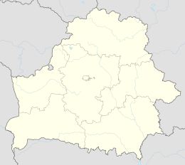
Djatlava
| Djatlava | Djatlowo | |||
| Дзятлава | Дятлово | |||
| ( Belarus. ) | ( Russian ) | |||
|
|||
| State : |
|
||
| Woblasz : |
|
||
| Coordinates : | 53 ° 28 ' N , 25 ° 24' E | ||
| Residents : | 7,853 (10/2009) | ||
| Time zone : | Moscow time ( UTC + 3 ) | ||
| Telephone code : | (+375) 1563 | ||
| Postal code : | BY - 231460 | ||
| License plate : | 4th | ||
|
|
|||
Dsjatlawa or Djatlowo ( Belarusian Дзятлава / Dsjatlawa ; Russian Дятлово / Djatlowo ; Yiddish Zhet (e) l; Lithuanian Zietela ; Polish Zdzięciół ) is an urban-type settlement in the Hrodsenskaja Woblaslandsz in western Belarus . The place with 7,853 inhabitants (2009) is the center of the Rajon of the same name , a Lithuanian language island and Roman Catholic enclave in the triangle of Poland / Lithuania / Belarus.
The place was first mentioned in manuscripts from 1498. Before the murder of the Jewish population of the place in two mass shootings by Germans on April 30 and August 6, 1942, the place was a so-called " shtetl ", i.e. a small town with a Jewish one Majority of the population of about 75%.
coat of arms
Description: In blue a golden wooden gate tower with an open passage and with a palisade wall on its sides on a three-mountain green shield base and in the tower a golden herb (arrow)
people
- Jacob ben Wolf Kranz (around 1740–1804), the Dubner Maggid
- Israel Meir Kagan (Chafetz Chajim) (1839-1933)
- Baruch Sorotzkin
literature
- Christian Ganzer: “Soviet Discourses - Djatlovo, a local museum in the Belarusian province.” In: Olga Kurilo (ed.): The Second World War in the Museum: Continuity and Change , Berlin 2007, pp. 133–148. ISBN 978-3-930064-82-3
Web links
- http://www.shtetlinks.jewishgen.org/Lida-District/dzya-encyc.htm About the history of the place (English)
- http://www.radzima.org/pub/miesta.php?lang=en&miesta_id1=hrdzdzia Photos at Radzima.org
- http://dyatlovo.com/ Information portal of the Rajon and the city of Djatlawa (Russian)
- http://dzyatlava.by/ Website of the Raion and the City (Russian)


