Eagle River (Bell River)
| Eagle River | ||
|
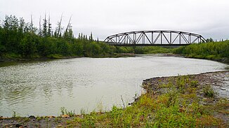
Bridge of the Dempster Highway over the Eagle River |
||
| Data | ||
| location | Yukon ( Canada ) | |
| River system | Yukon River | |
| Drain over | Bell River → Porcupine River → Yukon River → Bering Sea | |
| source | on Dempster Highway 66 ° 2 ′ 31 ″ N , 137 ° 16 ′ 12 ″ W. |
|
| muzzle |
Bell River Coordinates: 67 ° 17 ′ 59 " N , 137 ° 8 ′ 22" W 67 ° 17 ′ 59 " N , 137 ° 8 ′ 22" W.
|
|
| length | approx. 200 km | |
| Discharge at the Dempster Highway Bridge A Eo gauge : 1720 km² |
MQ 1978/1996 Mq 1978/1996 |
10 m³ / s 5.8 l / (s km²) |
The Eagle River ( English for " Eagle is -flow"), a left tributary of the Bell River in the Canadian Yukon Territory .
The river has its source on the Dempster Highway . It flows south of the trunk road in an easterly direction, later turns north. The Dempster Highway crosses the Eagle River ( ⊙ ) on its way to the Eastern Richardson Mountains . The Eagle River continues its course to the north and after about 200 km reaches the Porcupine River tributary Bell River. There is a drain gauge at the highway bridge. White water canoe tours use this point as a starting point. The 1½ to 2 week tours run downstream over the Bell River and Porcupine River to Old Crow .
Individual evidence
- ↑ Eagle River at the Dempster Highway Bridge gauge - hydrographic data from R-ArcticNET
