Elsinore Mountains
| Elsinore Mountains | ||
|---|---|---|
|
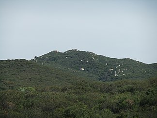
San Mateo Peak, highest point in the Elsinore Mountains |
||
| Highest peak | San Mateo Peak ( 1095 m ) | |
| location | Riverside County , California , United States | |
| part of | Santa Ana Mountains | |
|
|
||
| Coordinates | 33 ° 37 ′ N , 117 ° 23 ′ W | |
| Type | Mountain ridge | |
The Elsinore Mountains are a mountain range in Riverside County in California , United States . They are part of the larger Santa Ana Mountains . The highest point of the mountains is the unofficially named San Mateo Peak with 1095 m, followed by Elsinore Peak with 1078 m. These two highest peaks are connected by a mountain ridge .
The mountain range is in the Cleveland National Forest , which extends south to San Diego County . To the north of the Elsinore Mountains, however, is Lakeland Village and the larger city of Lake Elsinore . The Elsinore Mountains lead from the unincorporated El Cariso area in a southeast direction to Elsinore Peak . Here the mountains bend to the east and drop off.
Decker Canyon Creek , Morrell Canyon Creek and San Mateo Creek have their source on the west side of the Elsinore Mountains . The first two later flow together to form San Juan Creek , which flows into the Pacific . In the south of the mountains, Los Alamos Canyon Creek and Wildhorse Canyon Creek arise , which in turn flow into the San Mateo Creek. On the west side, with the exception of Murrieta Creek, all watercourses flow into nearby Lake Elsinore .
Web links
- Map at www.topoquest.com (English)

