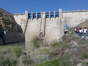
Embalse del Negratin
| Embalse del Negratin | |||||
|---|---|---|---|---|---|
|
|||||
|
|
|||||
| Coordinates | 36 ° 34 '20 " N , 2 ° 53' 16" E | ||||
| Data on the structure | |||||
| Construction time: | until 1984 | ||||
| Height above foundation level : | 575.5 m | ||||
| Height of the structure crown: | 642.5 m | ||||
| Crown length: | 439 m | ||||
| Operator: | Spanish state | ||||
| Data on the reservoir | |||||
| Water surface | 2 170 km² | ||||
| Storage space | 567 hm³ | ||||
The Embalse del Negratín is a reservoir in the Spanish province of Granada . It is located on the Río Guadiana Menor and in the territory of the municipalities of Guadix (with the exclave Bácor-Olivar ), Freila , Zújar , Baza , Benamaurel , Cortes de Baza and Cuevas del Campo .
Data
With an area of 2170 ha and a capacity of 567 hm³ is the third largest reservoir in the Autonomous Region of Andalusia (after the Embalse de Iznájar (981 hm³ ) and the Embalse de Guadalcacín (800 hm³ )). The dam is made of loose material because the left abutment is not stable enough for a concrete dam.
Surroundings
The reservoir was opened on December 31, 1984. The construction of Las Juntas (Bezierk Zújar), Baños de Zújar, the road between Zújar and Carramaiza and other individual farms (La Gata, Cortijo de los Contadores, Cortijo Seco) disappeared .
With the help of the dam, the area can be irrigated and hydropower can be used.


