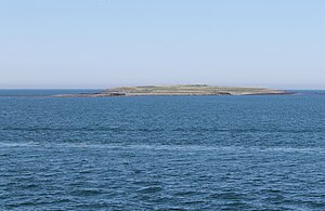
Engey
| Engey | ||
|---|---|---|
| Engey from the southeast | ||
| Waters | Atlantic Ocean | |
| Geographical location | 64 ° 10 ′ 16 ″ N , 21 ° 54 ′ 50 ″ W | |
|
|
||
| length | 1.7 km | |
| width | 400 m | |
| surface | 40.1 ha | |
| Residents | uninhabited | |
Engey is an island in the west of Iceland north of the capital Reykjavík . It is part of the municipality of Reykjavíkurborg , but does not belong to any of the ten districts of Reykjavíks, but to the Græni Trefillinn (Green Belt, hinterland of Reykjavíks).
geography
Engey closes Reykjavík Bay , after which the Icelandic capital is named, to the north. It is located 1700 meters east of the smaller island Akurey , from which it is separated by the Engeyjarsund, and 1600 meters west of Viðey .
After Viðey, Engey is the second largest island in Kollafjörður . It is 1.7 km long and up to 400 meters wide. Their area is 40.1 hectares .
history
There has been a lighthouse in the north of the island since 1905. Engey has been uninhabited since 1950.
Individual evidence
- ↑ Here the 220 hectare Geldinganes is counted as a peninsula , although it is only connected to the mainland by an artificial dam . ( PDF ( page no longer available , search in web archives ) Info: The link was automatically marked as defective. Please check the link according to the instructions and then remove this notice. )
- ↑ PDF at www.reykjavik.is ( Memento of the original dated December 7, 2011 in the Internet Archive ) Info: The archive link was inserted automatically and has not yet been checked. Please check the original and archive link according to the instructions and then remove this notice.
Web links
- Engey at www.nat.is ( engl. )

