
Fürwiggetalsperre
| Fürwiggetalsperre | |||||||||
|---|---|---|---|---|---|---|---|---|---|
 |
|||||||||
|
|||||||||
|
|||||||||
| Coordinates | 51 ° 8 '59 " N , 7 ° 41' 16" E | ||||||||
| Data on the structure | |||||||||
| Construction time: | 1902-1904 | ||||||||
| Height above valley floor: | 24.6 m | ||||||||
| Height above foundation level : | 29.1 m | ||||||||
| Height above the river bed : | 29.1 m | ||||||||
| Height of the structure crown: | 439.55 m | ||||||||
| Building volume: | 26th 000 m³ | ||||||||
| Crown length: | 166 m | ||||||||
| Radius of curvature : | 120 m | ||||||||
| Data on the reservoir | |||||||||
| Altitude (at congestion destination ) | 438.98 m | ||||||||
| Water surface | 18 ha | ||||||||
| Storage space | 1.67 million m³ | ||||||||
| Catchment area | 4.52 km² | ||||||||

The Fürwiggetalsperre between Meinerzhagen and Lüdenscheid dams six streams (Hülsebach, Drögenpütt, Fürwigge, Schürfelder Becke, Verse and Brinkbach). Until the construction of the new dam a few kilometers below it was called the Versetalsperre .
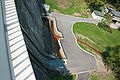
The gravity dam built from 1902 to 1904 under the direction of Otto Intze according to the Intze principle is the end of the highest situated dam in the Sauerland . It has a capacity of around 1.7 million cubic meters and is primarily used to supply drinking water. The operator is the Ruhrverband .
The restaurant above the dam has been closed since 2001.
Due to construction work on the dam from 2005 to 2007, the water was completely drained. There were u. a. a control passage built into the dam (by blasting) and the top of the wall renovated and provided with new railings.

Fürwiggetalsperre

Memorial for the first three “heads” of the dam on the dam

Dam during the modernization of the dam
The verse flows from the stilling basin to the nearby Versetalsperre


See also
swell
- ↑ Ruhrverband - Reinstauung the Fürwiggetalsperre: renovation instead of dismantling ( memento from September 11, 2012 in the web archive archive.today )