Fagnano lake
|
Lake Fagnano Lake Khami |
||
|---|---|---|

|
||
| Lago Fagnano, looking south over Chilean territory | ||
| Geographical location | on the Isla Grande de Tierra del Fuego ( Argentina , Chile ) | |
| Tributaries | Río Alonso, Río Betder, Río Claro, Río Milna, Río Tuerto, Río Turbio, Río Valdez | |
| Drain | Río Azopardo | |
| Places on the shore | Tolhuin | |
| Data | ||
| Coordinates | 54 ° 33 ′ S , 67 ° 59 ′ W | |
|
|
||
| Altitude above sea level | 140 m | |
| surface | 600 km² | |
| length | 104 km | |
| width | 6 km | |
| volume | 41 km³ | |
| Maximum depth | 204 m | |
| Middle deep | 70 m | |
Lake Fagnano ( Spanish: Lago Fagnano or from the Selk'nam language, Lago Kami or Lago Khami ) is a freshwater lake that cuts the border between Argentina and Chile from north to south.
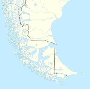
Lago Fagnano is located on the Isla Grande de Tierra del Fuego , the main island of the Tierra del Fuego archipelago . The 600 km² large lake extends in an east-west direction over 104 km, of which 90.5 km and 580 km² belong to the Argentine province of Tierra del Fuego and 13.5 km and 20 km² to the Chilean region Región de Magallanes y de la Antártica Chilena . The lake reaches a depth of 204 m.
In the west, the draining water becomes the Río Azopardo , which flows into the Almirantazgo fjord . At the eastern end of the lake is the city of Tolhuin .
It is named after the Salesian Giuseppe Fagnano (1844-1916), whom the Holy See appointed Apostolic Prefect of southern Patagonia , Tierra del Fuego and the Malvines in 1883 .
literature
- Hans Niemeyer Fernandez, Pilar Cereceda Troncoso: Hidrografía (Geografía de Chile; Vol. 8). Santiago de Chile 1983.
- Andreas Richter, Jose Luis Hormaechea, Reinhard Dietrich, Raúl Perdomo, Mathias Fritsche, Daniel del Cogliano, Gunter Liebsch, Luciano Mendoza: Lake-level variations of Lago Fagnano, Tierra del Fuego: observations, modeling and interpretation . In: J. Limnol. 69 (1), 2010, pp. 29-41
