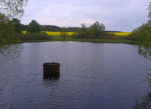
Lazy puddle pond
| Lazy puddle pond Lazy puddle pond, lazy puddle |
|||||||||
|---|---|---|---|---|---|---|---|---|---|
| Lazy puddle pond | |||||||||
|
|||||||||
|
|
|||||||||
| Coordinates | 51 ° 35 '39 " N , 11 ° 3' 23" E | ||||||||
| Data on the structure | |||||||||
| Construction time: | 1704 (1984) | ||||||||
| Crown length: | 240 m | ||||||||
| Data on the reservoir | |||||||||
| Total storage space : | 34,000 m³ | ||||||||
The Faule Pfützenteich is a reservoir in the Lower Harz in Saxony-Anhalt . The Glasebach is dammed up . From 1704 to 1912, a supply of water was also possible via the Schindelbrücher artificial ditch coming from the Gräfingründer pond .
description
The reservoir is located about two kilometers south of Straßberg (Harz) in Saxony-Anhalt. The pond is part of the reservoir cascade that was created for mining purposes . This was called The Three Faithful Neighbors . The puddle pond was originally its middle part.
The pond has a maximum length of around 90 meters and a width of around 200 meters. It is now used as a fish rearing water, which is why bathing is prohibited. The access road to the campsite at the Treuen neighboring pond leads over the dam of the lazy puddle pond.
history
The Faule Pfützenteich, west of the Treue neighboring pond, was built in 1703–1704 under the direction of Georg Christoff von Utterodt . The reservoir cascade was connected to the Unterharzer pond and ditch system in 1704 over the Schindelbruch artificial ditch. Networking made it possible to avoid water jams, which meant that the water wheels in the lower-lying mines could be supplied more reliably. The original pond had a storage capacity of around 10,000 m³.
The dam was renovated in 1984, with the pond dam being extended to a length of 240 meters. The stowage volume with full stowage has been around 34,000 m³ since then.
See also
literature
- Robert Wouters: Dams in Saxony-Anhalt . Ed .: Saxony-Anhalt dam operation. mdv, Halle (Saale) 2010, ISBN 978-3-89812-677-9 .
- Development and current function of systems of historical mining water management in the Lower Harz . In: Wilfried Strenz, Working Group Historical Geography of the Geographical Society of the GDR (ed.): Historical-geographical research in the GDR . Hermann Haack Geographisch-Kartographische Anstalt, Gotha 1986, ISBN 3-7301-0803-4 .

