Glasebach (Selke)
| Glasebach | ||
|
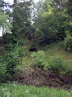
The Glasebach winds past the |
||
| Data | ||
| location | in the resin ; Districts Harz and Mansfeld-Südharz ; Saxony-Anhalt ( Germany ) | |
| River system | Elbe | |
| Drain over | Selke → Bode → Saale → Elbe → North Sea | |
| River basin district | Elbe | |
| source | in the Lower Harz near the lazy puddle pond (lazy puddle) 51 ° 35 ′ 44 ″ N , 11 ° 3 ′ 13 ″ E |
|
| Source height | approx. 450 m above sea level NHN | |
| muzzle | near Straßberg at the Bärlochsmühle in the Selke coordinates: 51 ° 37 '9 " N , 11 ° 3' 30" E 51 ° 37 '9 " N , 11 ° 3' 30" E |
|
| Mouth height | approx. 355 m above sea level NHN | |
| Height difference | approx. 95 m | |
| Bottom slope | approx. 26 ‰ | |
| length | approx. 3.7 km | |
| Reservoirs flowed through |
The three loyal neighbors (today) , Glasebacher Teich (formerly) |
|
| Small towns | Harzgerode | |
| Communities | South Harz | |
The Glasebach is a 3.7 km long, southern and orographically right tributary of the Selke in the Lower Harz . In Saxony-Anhalt, it flows almost exclusively in the Harz district and on a few upstream meters through the Mansfeld-Südharz district .
etymology
The name of the body of water consists of the determinant glass and -bach as an appellative . Evidence for the glass industry around Straßberg is not available. Therefore, glass, derived from Old High German or Middle High German glass , is likely to refer to the shine and brightness of water - a common variant for naming streams.
course
The Glasebach rises in the Harz nature park between Strassberg in the north, a southwestern district of the city Harzgerode and Hayn in the south, in neighboring Mansfeld-Südharz to the municipality Südharz belongs. Its source is about 450 m above sea level. NHN height a few meters west of the Faulen Pfützenteich (Faule Puddle) , the western of two still preserved reservoirs of the three loyal neighbors .
After flowing through the Lazy Puddle Pond and the Treue Neighboring Pond, the loyal neighbor to the east and 443.4 m above sea level, the stream flows northwards through agriculturally developed area. After about 500 meters the brook bends northeast at a height of 426.2 m and enters the Hirtengrund . About 800 m below the Treuen neighboring pond, an apparently nameless stream flows into the Glasebach on the left at an altitude of 417.2 m , which then continues to flow northeast. Another 400 m further down the stream, an equally nameless stream flows in on the right. The stream, which has so far been running in gentle curves, flows along the meandering south-east and east foot of the Pfaffenberg ( 440.7 m ).
Then the Glasebach runs through the former basin of the Glasebach pond , which was built in 1716 in the Glasebachtal at a height of about 400 m , into which water was discharged from a water solution tunnel from the Pfennigturm pit . Its dam broke in 1752 as a result of a storm; Parts of the dam, through whose break the stream winds, are still there, the pond no longer. Shortly before the dam, an unnamed stream flows into the Glasebach on the right-hand side, as the second tributary of the Glasebacher pond.
Then the Glasebach, which winds through grassland in its lower reaches, flows further in the Glasebachtal towards north-northwest, following the west foot of the Eichberg ( 430.6 m ) north of the Könnickenberg ( 452.8 m ), while on the right-hand side a 150 m long and coming from the Eichberg slope Inflow joins.
Then opens the right side Glasebach east of Strassberg near the Bärlochsmühle to about 355 m in the Selke. The confluence takes place at river kilometer 54.6 of the Selke.
Individual evidence
- ↑ a b c d e f g h Map services of the Federal Agency for Nature Conservation ( information )
- ↑ a b c Saxony-Anhalt viewer, official topographical map, TK 1: 25,000, color
- ↑ Elfriede Ulbricht: The river basin of the Thuringian Saale . 1st edition. Max Niemeyer, Halle (Saale) 1957.
- ↑ Glasebacher pond in Bergbautannen Straßberg , on strassberg-harz.de
- ↑ The influence of mining history in the Eastern Harz on the heavy metal depth gradients in historical sediments and the fluvial heavy metal dispersion in the catchment areas of Bode and Selke in the Harz , dissertation at the Martin Luther University Halle-Wittenberg, October 19, 1998, Lorenz Dobler, on d -nb.info (PDF; 2.21 MB)
