Fennsee (Westhavelland)
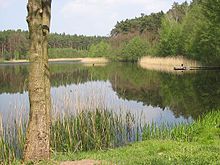
The Fennsee is a lake in the Westhavelland Nature Park near Ferchesar northeast of Rathenow in Brandenburg ; Signs on site also refer to the water as a fente pond . It has an elongated shape of around 500 meters and lies between the Hohennauener-Ferchesarer See and the Trintsee on the southern edge of the "Ferchesarer Heide". The scenic lake is surrounded by a hiking trail.
history
The Fennsee was created in the 20th century. Previously there was a damp swampy depression with a meadow in the area. It was only with the use of the fen for peat extraction and the peat digging, which lasted into the 20th century, that the water that formed the lake collected in the cavities. The peat was not extracted here, as is traditionally customary, for the production of fuel, but used as an admixture for the arable land - this is the reason for the extraction until recently. The field name "Fenn" or "Fenne", which is common in Havelland and Teltow, refers to a swampy or deepened lake or pond without solid ground , according to Hermann Teuchert and, according to Agathe Lasch and Conrad Borchling, swamp, moorland, swampy pastureland overgrown with grass or röricht , both quotations reproduced here after Gerhard Schlimpert.
The term has a Dutch origin and goes back to the colonization of different parts of the Mark Brandenburg by Flemings , who already in the second half of the 12th century for the state development of the just founded Mark Brandenburg by the first Margrave Albrecht the Bear and his son and successor Otto I. . were called into the country. In the 18th century, several thousand Dutch specialists were recruited again and recruited as settlers with the donation of tax-free land, who played a leading role in the draining of the Havelländischer Luchs from 1718 and later the Rhinluchs from 1779 and the establishment of various canals.
In the village of Ferchesar, the Flemish term lives on in the street names “Großes Fenn” and “Kleines Fenn”, which refer to the fact that this was originally a silted up part of Lake Ferchesar, which almost reached today's Fennsee.
literature
- Westhavelland-Nord Nature Park , topographic map 1:50 000, edition with hiking trails. Landesvermessungsamt Brandenburg 2000, ISBN 3749040796 Contrary to the signs on site as "Fennteich", this map uses the term "Fennsee" under "Hike 1".
- Gerhard Schlimpert , Brandenburg name book . Part 3: The place names of the Teltow . Hermann Böhlaus Nachf., Weimar 1972. Quotes on the term “Fenn” on page 74, and on page 38 on the Fenn.
Web links
Coordinates: 52 ° 39 ′ 38 ″ N , 12 ° 27 ′ 36 ″ E
