
Fishbourne (West Sussex)
| Fishbourne | ||||
|---|---|---|---|---|
|
 Row of houses on the A259 through road |
|||
| Basic data | ||||
| status | Village and Civil Parish | |||
| surface | 3.87 km² | |||
| population | 2325 (as of 2011) | |||
| Ceremony county | West Sussex | |||
| District | Chichester District | |||
| Constituency | Chichester | |||
| Website: www.fishbourne-pc.gov.uk | ||||

Fishbourne is a village and civil parish in the English county of West Sussex , about 3 km from Chichester .
location
The place is at the end of a spur of the Bay Chichester Canal in the estuary of several small rivers. The name is also attributed to the location on a lake rich in fish. The older part of the village is in the immediate vicinity of the coast, the newer part further inland.
history
The history of the village can be traced back to Roman times .
The earliest written medieval evidence shows that Fishbourne was owned by the Abbey of Séez in Normandy in the 11th century . From 1419 the place belonged to the monastery of Syon , from 1540 it came into the possession of noble families and changed the landlord several times over the centuries.
It was not until 1987 that today's place became an independent municipality. Before that, it was split in two. The part called "Old Fishbourne" belonged to the municipality of Bosham , the part called "New Fishbourne" or "East Fishbourne" belonged to the city of Chichester.
Buildings
The most important historical building in the area is a large Roman villa , the " Fishbourne Roman Palace " with famous mosaics, for which a museum was built. Large parts of the complex are still believed to be under today's A27 and the residential areas of the place, so it may never be completely excavated.
The church of St Peter and St Mary is the second historically interesting building in the town. It is already mentioned in a register from the years 1243/54. The oldest parts are probably from the 13th century, it has extensions from the 14th and 17th centuries.
The two active pubs , the "Bulls Head" and the "Woolpack" also use historical buildings.
Economy and population
The population with 46 years a rather high average age , ethnic minorities are at the place hardly. The vast majority of all employees work in the service sector. The population was 1953 in 2001.
Infrastructure and public facilities
Fishbourne is touched by three traffic axes in an east-west direction. The old main road between Chichester and Portsmouth , the A259 runs through the southern district, the Brighton-Southampton railway line runs through the center of the village via Fishbourne station, the new dual carriageway between Chichester and Portsmouth, the A27 forms the northern boundary of the municipality. So the place is well connected to the local transport network.
In the western part of the village there is a large sports area and the community center, where a variety of sporting and social activities are offered. The place has two state schools, a preschool and a primary school , all secondary schools and other private schools are in Chichester.
photos

The Bulls Head Pub
The newer district north of the railway line

Train station

The church of the place
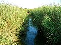
The wetlands south of the resort


_station_geograph-3519030-by-Ben-Brooksbank.jpg)


literature
- Victoria County History (Ed.): A History of the County of Sussex . tape 4 , 1953, pp. 154–156 ( online [accessed March 8, 2019]).
- Fishbourne Parish Council (Ed.): Welcome to Fishbourne . 2019 ( online [PDF; accessed March 8, 2019]).
Web links
- Fishbourne Parish homepage
Individual evidence
- ↑ Brief description on the municipal administration website. Retrieved March 8, 2019.
- ^ Representation of Fishbourne on the West Sussex region website. Retrieved March 8, 2019.
- ↑ a b Local Area Report for Fishbourne on the nomisweb information system of the Office for National Statistics ; accessed on March 8, 2019.
- ↑ 2001 Census: West Sussex - Population by Parish ( Memento of June 8, 2011 in the Internet Archive )
- ^ Homepage of the community center "The Fishbourne Center". Retrieved March 8, 2019.
Coordinates: 50 ° 50 ′ N , 0 ° 49 ′ W