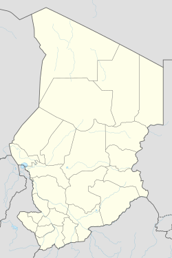
Am Timan Airport
| Am Timan Airport | ||
|---|---|---|
|
|
||
| Characteristics | ||
| ICAO code | FTTN | |
| IATA code | AMC | |
| Coordinates | ||
| Height above MSL | 433 m (1421 ft ) | |
| Transport links | ||
| Distance from the city center | 1 km west of Am Timan , Chad | |
| Start-and runway | ||
| 03/21 | 1850 m × 20 m earth | |
The Airport Am Timan ( IATA : AMC , ICAO : FTTN ) (Arabic: مطار م تيمان) is the airport of the city of Am Timan in the southeast of Chad . It is located at an altitude of 433 meters above sea level .
Airlines and Destinations
There are currently no scheduled flights to the airport .
Web links
Individual evidence
- ↑ 14 AD 2-7 Répertoire des Aérodromes et Pistes / List of Aerodromes and Rwy. (PDF; 112 kB) (No longer available online.) In: AIP TCHAD. Agence pour la Sécurité de la Navigation Aérienne en Afrique et à Madagascar (ASECNA), December 8, 2016, p. 1 , archived from the original on March 5, 2016 ; accessed on September 10, 2017 (French; English). Info: The archive link was inserted automatically and has not yet been checked. Please check the original and archive link according to the instructions and then remove this notice.
- ↑ Landings.com copyright: Airport Records. Retrieved September 9, 2017 .
- ↑ Google Maps GPS coordinates, latitude and longitude. Retrieved September 9, 2017 .
