Airfield Alert
| Airfield Alert | |
|---|---|

|
|
| Characteristics | |
| ICAO code | CYLT |
| IATA code | YLT |
| Coordinates | |
| Height above MSL | 30 m (98 ft ) |
| Transport links | |
| Distance from the city center | 3 km north of Alert |
| Basic data | |
| opening | 1958 |
| operator | Canadian Department of National Defense |
| Employees | approx. 75 |
| Start-and runway | |
| 05T / 23T | 1676 m × 46 m gravel |
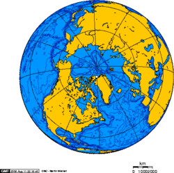
The Alert Airport is located at the northernmost air base of the earth. It is located on the Canadian territory of Nunavut , approximately 840 km south of the geographic North Pole , and was built in 1958 when the Alert military base was built. The airfield is operated by the Canadian military and is closed to civil aviation. It is mainly used to transport people and goods when it is not possible to get through by ship due to the extremely short arctic summer and the pack ice . Weekly supply flights with C-130 and C-17 ensure that the CFS Alert is supplied.
There have been two aircraft accidents so far because of the icy runway.
Web links
- History of the Alert airfield (PDF; 3.8 MB)
Individual evidence
- ↑ prokerala.com: Alert Airport (YLT). Retrieved July 18, 2011 .
- ↑ US Air Force: Dover Reserve aircrew supports Canada's Operation Boxtop. Retrieved July 18, 2011 .
- ↑ A Welsh View: The World's Most Northerly ... Retrieved July 18, 2011 .
- ^ J. Peter Johnson: The Establishment of Alert, NWT, Canada. (PDF; 3.8 MB) Retrieved July 18, 2011 .
- ↑ Jerry Proc: CFS Alert. Retrieved July 18, 2011 .