Krems airfield
| Krems – Langenlois airfield | ||
|---|---|---|
|
|
||
| Characteristics | ||
| ICAO code | LOAG | |
| Coordinates | ||
| Height above MSL | 312 m (1024 ft ) | |
| Transport links | ||
| Distance from the city center | 4 km northeast of Krems | |
| Street | Kremser Strasse (B37) Langenloiser Strasse (B218) | |
| Local transport | Regional bus route 1405 | |
| Basic data | ||
| opening | June 24, 1969 | |
| operator | Union Sportfliegerclub Krems | |
| Start-and runway | ||
| 11/29 | 904 m × 18 m asphalt | |
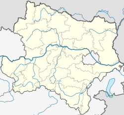
The Krems-Langenlois airfield ( ICAO code : LOAG ) is a private Austrian airfield in Gneixendorf, a place in the city of Krems on the Danube in Lower Austria. It is used for powered flights, helicopters, gliders, balloon flights and skydiving. The operator is the Union Sportfliegerclub Krems . The airfield has an asphalt runway and a grass runway for gliding operations.
history
The airfield is located on the area of the former prisoner of war camp STALAG XVII B. After the war, the camp was leveled and a runway made of grass was built. In 1969 the city of Krems bought the airfield, and an asphalt runway and four hangars with 2500 square meters of floor space were built. A control tower with glass all around and a restaurant were also built.
In 2015, the Christophorus 2 rescue helicopter from the Christophorus Air Rescue Association moved from the Krems University Hospital to this airfield.
use
The airfield is used as a base by hail pilots who protect the surrounding vineyards from storms.
Web links
Individual evidence
- ↑ Christophorus 2 receives new base on ORF from June 10, 2015, accessed on June 11, 2015
