Forty Mile (Yukon)
| Forty Mile | ||
|---|---|---|
 Image of Forty Mile and the confluence of the Fortymile River into the Yukon from 1897 |
||
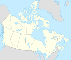
| Location in Yukon | ||
|
|
||
| State : |
|
|
| Territory : | Yukon | |
| Coordinates : | 64 ° 27 ′ N , 140 ° 33 ′ W | |
| Area : | 0 ha | |
 Former North West Mounted Police building in Forty Mile |
||
Forty Mile is a ghost town in the Yukon Territory of Canada .
The settlement arose in the winter of 1887 at the mouth of the Fortymile River in the Yukon after gold was found nearby in 1886. Forty Mile was the first city in the Yukon Territory. At the heyday at the end of the 19th century, the place had 700 inhabitants.
The Hän , ancestors of the Tr'ondek Hechsel'in First Nation , used the area around Forty Mile for about 2000 years. In winter the herds of caribou crossing the Yukon were hunted and in spring and summer salmon fishing was carried out.
In 1886 Jack McQuesten , Alfred Mayo and Arthur Harper established a trading post for the Alaska Commercial Company here . In 1887 the first police station and the first Anglican mission school in the territory were established in Forty Mile. In 1894 a trading post of the North American Transportation and Trading Company followed , a library, several saloons and restaurants, a theater and some distilleries. With the beginning of the gold rush on the Klondike River in 1896, most of the residents left the place again. Only a few of the buildings still exist today.
Since 1998, Forty Mile has been jointly owned and managed by the Tr'ondëk Hwëch'in and the territory's government, along with the Fort Constantine and Fort Cudahy Historic Sites .
The nearest town is Dawson 77 km upstream. Forty Mile has been accessible from the Top of the World Highway to Clinton Creek since the late 1960s .
