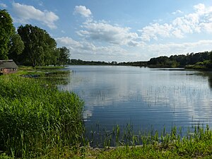
Friedländer mill pond
| Friedländer mill pond | ||
|---|---|---|

|
||
| Geographical location | District of Mecklenburg Lake District | |
| Tributaries | Fulling mill ditch | |
| Drain | to date | |
| Places on the shore | Friedland | |
| Location close to the shore | Friedland | |
| Data | ||
| Coordinates | 53 ° 39 '52 " N , 13 ° 32' 21" E | |
|
|
||
| Altitude above sea level | 13.2 m above sea level NHN | |
| surface | 22 ha | |
The Friedländer Mühlenteich is located in the urban area of Friedland in the Mecklenburg Lake District, a little southwest of the city in the lowlands of the Datzetal. It is located in the foothills of the Friedländer Große Wiese . The pond is fed via the Walkmühlengraben, a tributary of the Datze that runs north of the pond. Due to the artificial construction of the pond, the size fluctuates depending on the water level. The dry part remains swampy. There is evidence that the pond already existed in the Middle Ages. It served in particular to operate the Amtsdamm mill and to protect the city towards the south. The mill was mentioned in the Friedländer Urbanium from 1406.

