Fries Street
| Fries Street | ||
|---|---|---|
| Connects waters | Sea of Okhotsk | |
| with water | Pacific Ocean | |
| Separates land mass | Iturup | |
| of land mass | Urup | |
| Data | ||
| Geographical location | 45 ° 31 ' N , 149 ° 10' E | |
|
|
||
| Smallest width | 42 km | |
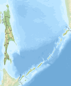
The Fries Street (also de Vries Street , Russian Пролив Фриза , Proliv Friza ) is a strait between two main Kuril islands . It lies between the northeast tip of Iturup and the southwest headland of Urup . It connects the Sea of Okhotsk in the west with the Pacific Ocean in the east. Its width is 42 km.
The road was named after the Dutch explorer Maarten Gerritszoon de Vries , the first known European to explore this region in 1643.
Individual evidence
- ↑ THE 17TH AND 18TH CENTURIES (engl.) ( Memento of the original March 25, 2008 at the Internet Archive ) Info: The archive link is automatically inserted and not yet tested. Please check the original and archive link according to the instructions and then remove this notice.
