Friesland Ridge
| Friesland Ridge | ||
|---|---|---|
|
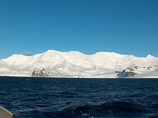
View from Bransfieldstrasse on the Friesland Ridge |
||
| Highest peak | Mount Friesland ( 1700 m ) | |
| location | Livingston Island , South Shetland Islands | |
| part of | Tangra Mountains | |
|
|
||
| Coordinates | 62 ° 42 ′ S , 60 ° 14 ′ W | |
Friesland Ridge ( Bulgarian Хребет Фризия Chrebet Frisija ) is a mountain ridge in the east of Livingston Island in the archipelago of the South Shetland Islands . It forms the western part of the Tangra Mountains . With a length of 15.5 km and a width of 5 km it extends from Botev Point in a north-easterly direction to the Shipka Saddle . The highest point at 1700 m is Mount Friesland .
Mapping was carried out by British scientists in 1968, by Spanish scientists in 1991 and by Bulgarian scientists from 1995 to 1996. The Bulgarian Commission for Antarctic Geographical Names named it in 2002 based on the name of Mount Friesland.
Web links
- Friesland Ridge in the Composite Gazetteer of Antarctica (English)

